

Dallas weather: Fast-moving storms bring marginal risk of severe weather

Dallas Weather: Feb. 22 morning forecast
FOX 4 Weather meteorologist Evan Andrews says the heaviest rain is starting to move out of the immediate metroplex. The storms haven't been severe but could produce 30-40 mph wind gusts.
Temperatures will soared well into the 80s on Tuesday, making Texas the warmest place in the nation, but tomorrow morning we could see some severe weather.
A storm off the coast of Mexico is expected to break free on Tuesday and start making its way to North Texas.
Winds will crank up on Tuesday, especially after sunset.
READ MORE: NASA confirms 1,000-pound meteor hit the ground in Texas
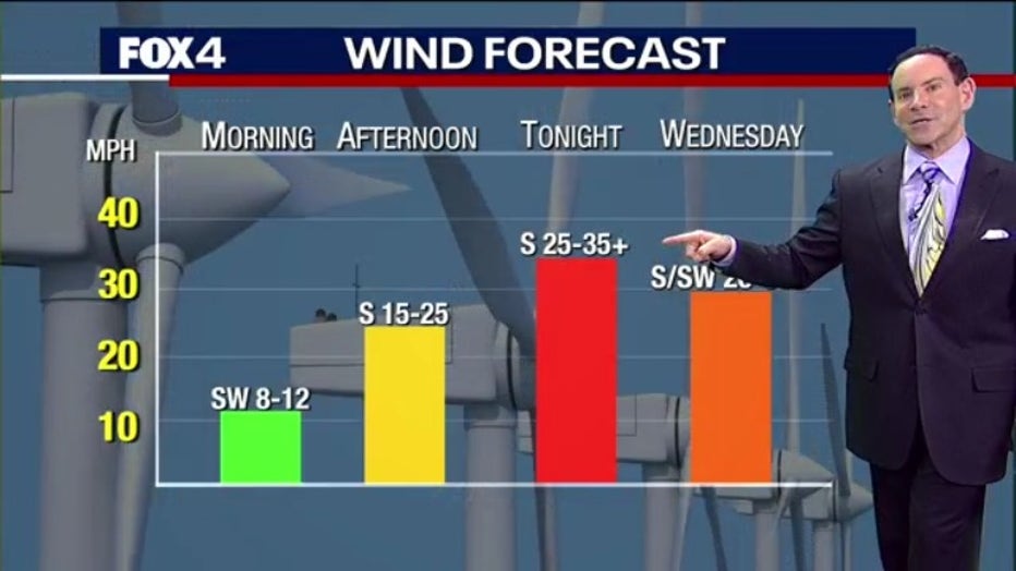
We expect there to be 25 to 35 mile per hour winds by Tuesday night with 40 mile per hour gusts.
Rain is also expected.
As the line of storms moves across North Texas tonight there is a chance of severe weather, but it will be quick because the storm is moving at about 50 miles per hour.
READ MORE: Why North Texas has seen such amazing sunrises and sunsets this week

The counties to the north of DFW have a marginal risk of severe weather. If you live to the west you can expect the storms to move through from about 3 a.m. to 4 a.m. People to the east should expect it at about 9 a.m. to 10 a.m. Be sure to take in the trash cans and the cushions on your patio furniture, or you may have to pick it up from down the street.

READ MORE: Texas Baptist Men sending aid to Turkey and Syria
After the storms Wednesday morning, things should be fairly nice, with the sun returning in the evening hours.
7-Day Forecast
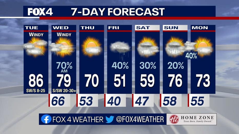
Things will be mild on Thursday with high temperatures in the 70s.
Those temperatures will dive on Friday and Saturday with highs in the 50s. There will also be some light rain.
It will warm up again on Sunday with temperatures back up into the 70s.