

Dallas Weather: Chance for storms in parts of North Texas

Mesquite peppered with hail on Thursday
FOX 4 viewer Darci Branche shared video of her pool getting pelted with hail on Thursday.
A Severe Thunderstorm Warning has been issued on Thursday in parts of North Texas.
The cap has broken creating conditions that would allow for severe weather.
Pea-sized and quarter-sized hail has been reported, but larger hail and damaging winds are possible.
Much of North Texas is under a ‘slight’ risk of severe weather on Thursday, which is a 2 on the National Weather Service's 1-5 scale.
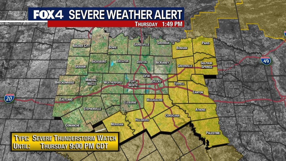
A Severe Thunderstorm Watch has been issued until 9 p.m. for areas to the south and east of DFW.
In the DFW area, the storms will likely develop between noon and 4 p.m.
To the east and south, the highest chance of storms is from 4 p.m. to 9 p.m.
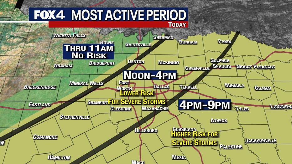
The biggest risk is for hail and damaging winds in the DFW area and to the east and south. The hail could be as big as golf balls for those east and southeast.
Ping pong ball-sized hail fell in Mesquite.
If the storms are big enough there will be a flooding risk in the southern counties in the evening hours.
7-Day Forecast
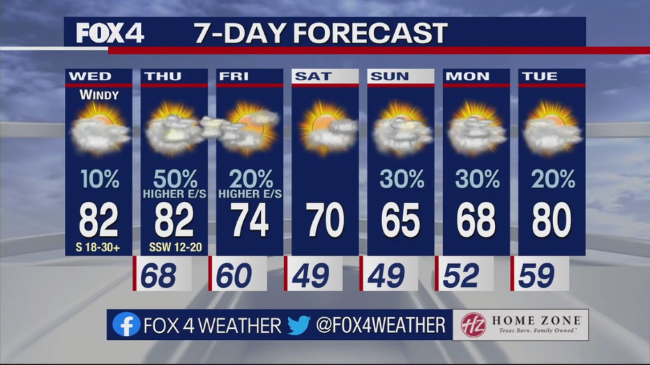
There could be some rain sticking around in the morning on Friday, mainly to the east and south.
Things will stay dry on Saturday before rain chances return on Sunday.
Sunday could see some showers and rumbles of thunder.
On Monday, there will be some scattered showers.