

Dallas Weather: Thunderstorm Watch issued for parts of North Texas Thursday

Dallas weather: April 18 evening forecast
A Thunderstorm Watch was issued for much of North Texas on Thursday night. FOX 4's Dan Henry has a look at the forecast.
DALLAS - A Thunderstorm Watch has been issued for a large portion of North Texas on Thursday night.
A Severe Thunderstorm Watch was issued for Anderson, Bosque, Collin, Dallas, Delta, Ellis, Fannin, Freestone, Hamilton, Henderson, Hill, Hopkins, Hunt, Kaufman, Lamar, Limestone, Navarro, Rains, Rockwall and Van Zandt County until 11:00pm.
MORE: Dallas-Fort Worth Weather
The front will reach the Metroplex between 4 p.m. and 7 p.m., and that’s the most likely timeframe for strong to severe storms with a hail and wind risk.
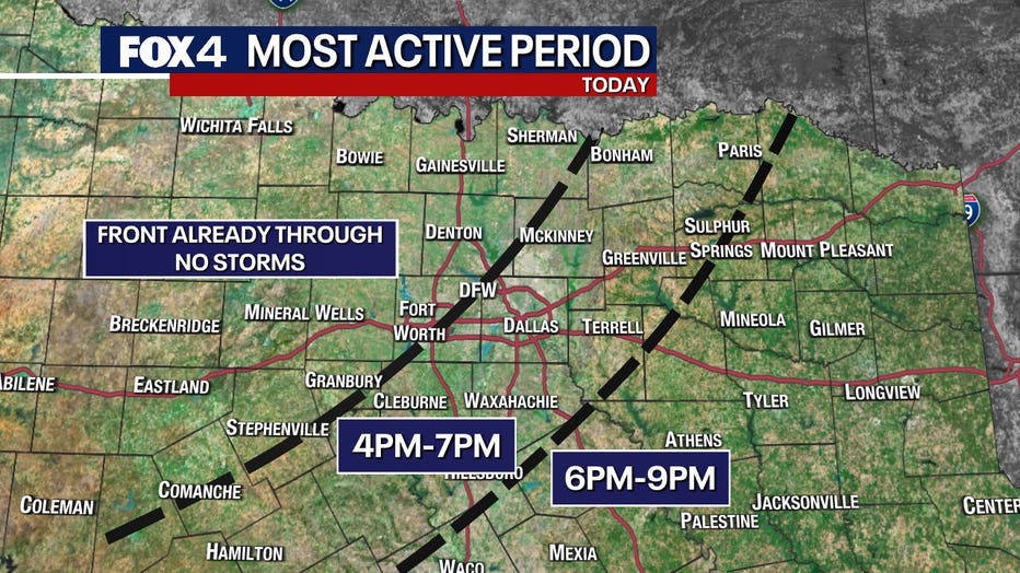
Coverage is not expected to be widespread, so not everyone will get wet. The storms will also die down pretty quickly, moving east of the Metroplex by 7 p.m.
Live Weather Radar - North Texas

7-Day Forecast

Friday will be cloudy and on the cooler side with highs closer to 70.
The rain returns on Saturday.
It won’t rain the whole day and the coverage is just 70% to 80% (so that’s not everyone). But with that said, it will still be wet and cool.
The northeast breeze will make it feel like the low 60s. That’s pretty chilly for mid-April.
Sunday starts chilly and breezy with the showers exiting in the morning.
Even with some afternoon sun, Sunday will be about 10 degrees below average.
The weather will be nice again on Monday just as everyone returns to work and school. It will be a beautiful day with sun, dry air, and mild temperatures.