

Dallas weather: Severe storm chances move east of the Metroplex

A night of storms across North Texas brought torrential rain, strong winds and large hail to the area.
Some of the storm cells produced hail, and there were reports of hail across multiple counties. The heavy rain was widespread.
There was a tornado warning for one of the storms in Johnson County, but the biggest threat was hail.

Video out of the Wise County town of Rhome shows hail as large as golf balls fell from a severe storm there.
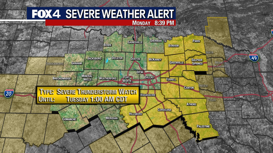
The Severe Thunderstorm Watch has been extended into East Texas until 1 a.m., but most of North Texas seems to be in the clear. Dallas, Tarrant and Denton counties and points west have been removed from the original watch.
There was some small hail in parts of Denton County.
The storm began rolling through the area south of Denton off 35-E around 7:30 p.m., bringing rain, strong winds, thunder, lightning and even some hail.

Hail and heavy rain in Denton County Monday
The storm began rolling through the area south of Denton off 35-E around 7:30 p.m., bringing rain, strong winds, thunder, lightning and even some hail.
During the peak of the storm, dozens of drivers pulled over to the Buc-ee’s gas station and waited everything out underneath the wide awning.

"In the span of five minutes, it went from sprinkling all the way down to a heavy downpour," said driver Shawn Feagley. "With the rain and the hail and hopefully I can keep me and my truck safe."
It got to the point where every space for parking underneath the awning was full of vehicles just waiting for the storm to pass.

Tornado Watch vs. Tornado Warning: What's the difference?
FOX 4 meteorologists Dan Henry and Ali Turiano break down the differences between a tornado watch and a tornado warning.
Dallas-Fort Worth Live Radar

7-Day Forecast

Monday's storms should clear out by early Tuesday morning.
Tuesday should be a windy day with highs only in the low 60s.
The rest of the work week should be fairly dry, with high temperatures between 70 and 80 degrees.
Our next chance of storms could move Saturday into Sunday.