

June 15 overnight forecast
Dan Henry has the latest forecast
Dan Henry has the latest forecast
June 15 afternoon forecast
Dan Henry has the latest forecast
Dan Henry has the latest forecast

June 15 morning forecast
Meteorologist Evan Andrews say's it's going to be hot this week. But... it could be worse.
Meteorologist Evan Andrews say's it's going to be hot this week. But... it could be worse.

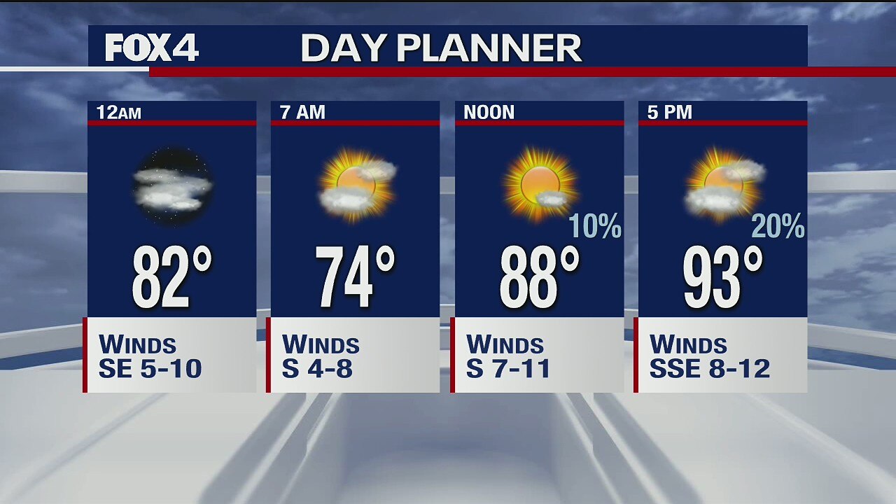
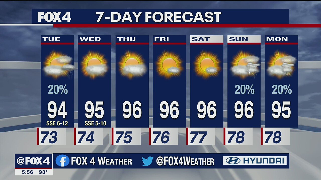
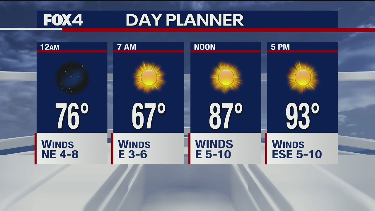
June 14 Weather Forecast
It's going to be a hot week here in North Texas, with chances of storms next week.
It's going to be a hot week here in North Texas, with chances of storms next week.

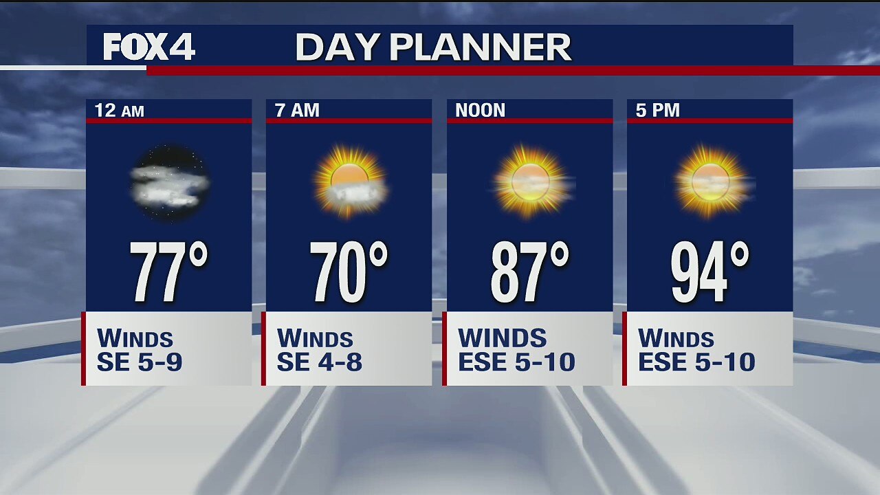
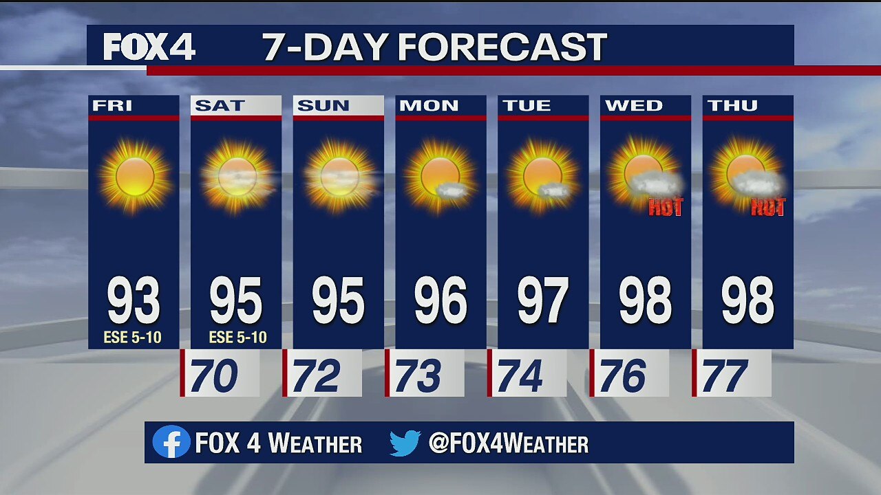
June 13 Forecast
It's going to remain hot here in North Texas.
It's going to remain hot here in North Texas.
June 12 overnight forecast
Dan Henry has the latest forecast.
Dan Henry has the latest forecast.
June 12 morning forecast
Meteorologist Kylie Capps takes a look at your weekend forecast. It's going to be hot!
Meteorologist Kylie Capps takes a look at your weekend forecast. It's going to be hot!
June 11 overnight forecast
Dan Henry has the latest forecast
Dan Henry has the latest forecast

June 11 afternoon forecast
Dan Henry has the latest forecast.
Dan Henry has the latest forecast.

June 11 morning forecast
Meteorologist Kylie Capps says it's going to be another nice day. Enjoy it while it lasts.
Meteorologist Kylie Capps says it's going to be another nice day. Enjoy it while it lasts.

June 10 overnight forecast
Dan Henry has the latest forecast.
Dan Henry has the latest forecast.

June 10 Evening Forecast
After a cooler Wednesday, temperatures will be in the high 90s for the next week.
After a cooler Wednesday, temperatures will be in the high 90s for the next week.

June 10, 2020 forecast
Pleasant June day for North Texas.
Pleasant June day for North Texas.

June 9 overnight forecast
Ali Turiano has the latest forecast.
Ali Turiano has the latest forecast.

June 9 afternoon forecast
Ali Turiano has the latest forecast.
Ali Turiano has the latest forecast.

June 9, 2020 forecast
A midday cool front should drop humidity levels across the region.
A midday cool front should drop humidity levels across the region.

June 8 overnight forecast
Ali Turiano has the latest forecast.
Ali Turiano has the latest forecast.

June 8 afternoon forecast
Ali Turiano has the latest forecast.
Ali Turiano has the latest forecast.

June 7 Forecast
It will be another hot day Sunday, and we could get into the 100s later this week.
It will be another hot day Sunday, and we could get into the 100s later this week.

June 6 Weather Forecast
It's going to be a hot weekend here in North Texas.
It's going to be a hot weekend here in North Texas.