Hail, wind, flooding and tornadoes possible Wednesday in North Texas

April 28th Evening Forecast
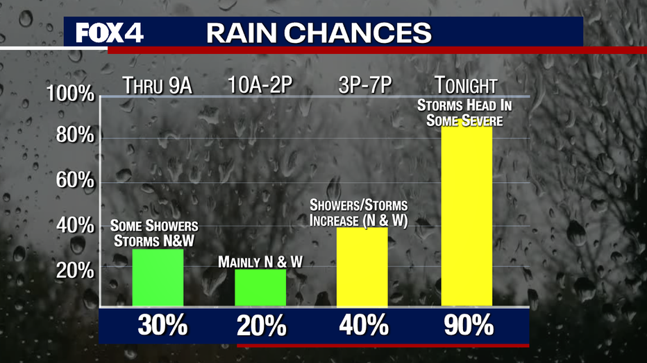
The chances for severe weather continue for much of North Texas into Wednesday night.
DALLAS - The storm risk has been upgraded to "Enhanced" for parts of North Texas Wednesday afternoon and evening.
FOX 4 Meteorologist Evan Andrews said Wednesday will start off warm and muggy with temperatures at or above 70 degrees. But by Wednesday evening, a cold front will move in with a strong upper-level disturbance.
The storms will likely develop along and west of Interstate 35W and could easily be severe.
Widespread showers and storms with heavy rain could also bring strong winds, hail and isolated tornadoes. Flooding is also possible.
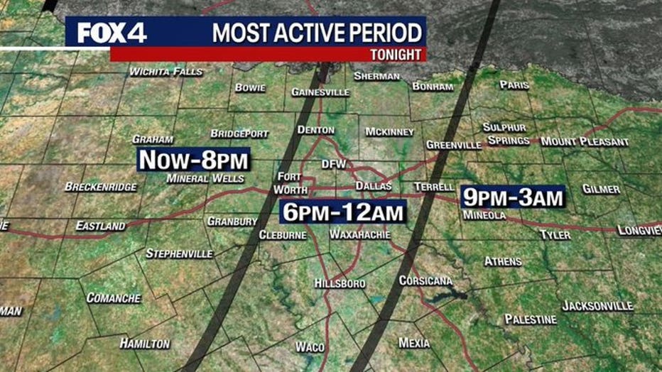
The storms will move in from the west, with the most active period for storms west of the I-35 being until 8 p.m. For much of the Metroplex, the most active period will be from 6 p.m. to midnight.
While areas east of the Metroplex will see storm from 9 p.m. to 3 a.m.
For the latest weather updates, follow FOX 4 Weather on Facebook and Twitter. Download the FOX 4 WAPP to get severe weather alerts and keep an eye on the radar.