

Thursday Afternoon Forecast
We keep the clouds around this afternoon! Here's your afternoon forecast.
We keep the clouds around this afternoon! Here's your afternoon forecast.

Quiet New Year! (So Far)
Mild south winds today, cooler NW winds tomorrow...lots of clouds, BUT nothing crazy to start the new year! We even get a nice weekend. Enjoy!
Mild south winds today, cooler NW winds tomorrow...lots of clouds, BUT nothing crazy to start the new year! We even get a nice weekend. Enjoy!
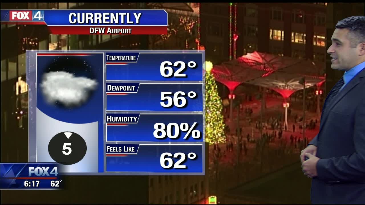
Happy New Year!
It's the first day of 2020! Here's your forecast.
It's the first day of 2020! Here's your forecast.
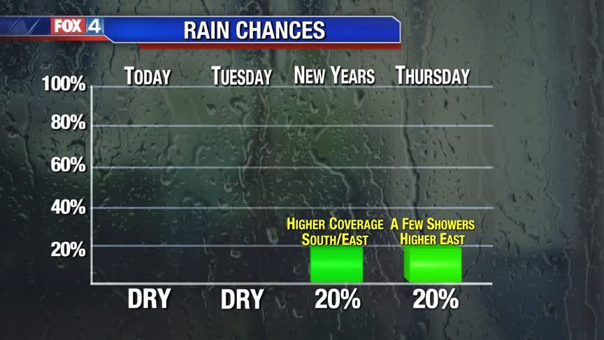
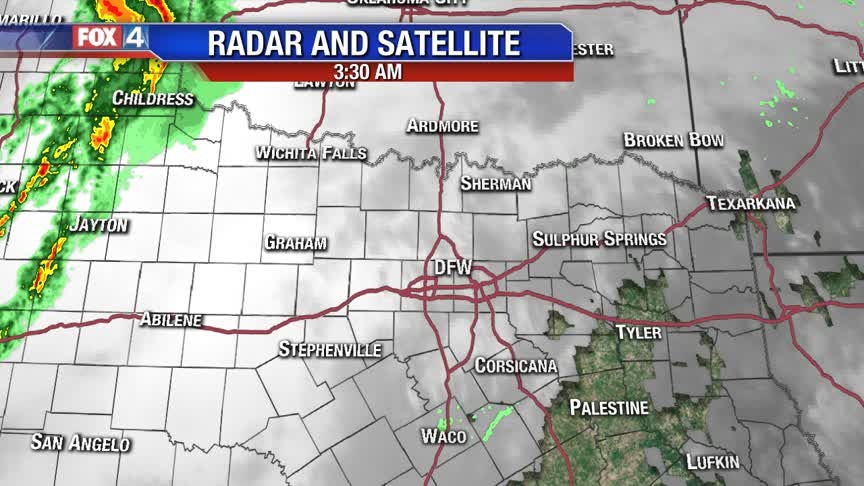
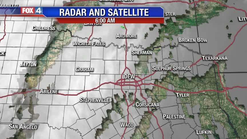
Some Rain To Start 2020!
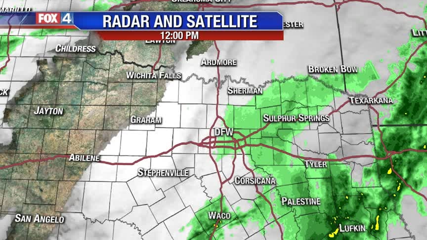
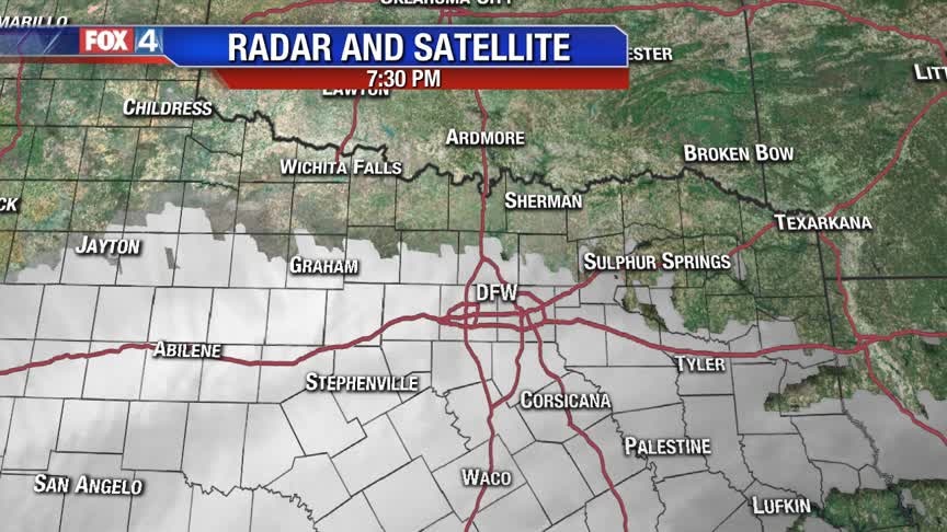
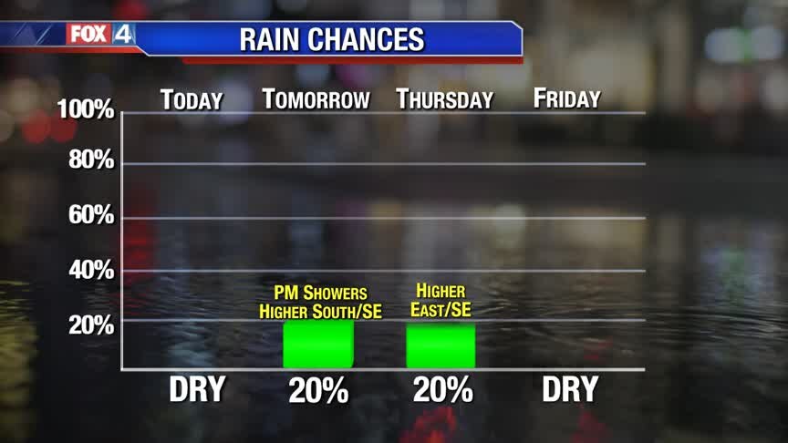
High pressure remains in control today, keeping seasonal and rain-free conditions in place for the last day of 2019. Wednesday, clouds increase and low rain chances return in the afternoon, especially south and east of DFW. We dry out just in time for the weekend.
High pressure remains in control today, keeping seasonal and rain-free conditions in place for the last day of 2019. Wednesday, clouds increase and low rain chances return in the afternoon, especially south and east of DFW. We dry out just in time for the weekend.
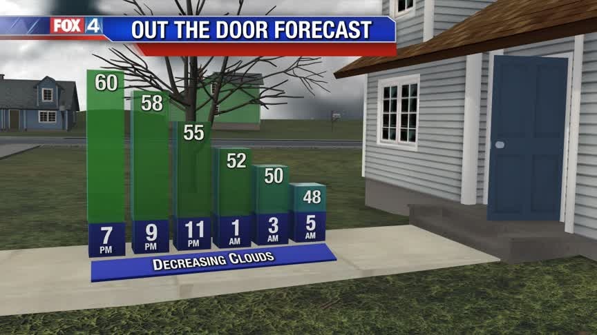
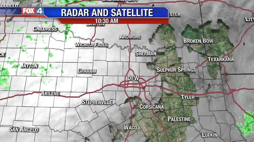
Pleasant End To The Decade!
After starting below freezing this morning, we heat up nicely this afternoon. The 50s stick around today and tomorrow, with low shower chances returning to close out the first day of 2020.
After starting below freezing this morning, we heat up nicely this afternoon. The 50s stick around today and tomorrow, with low shower chances returning to close out the first day of 2020.
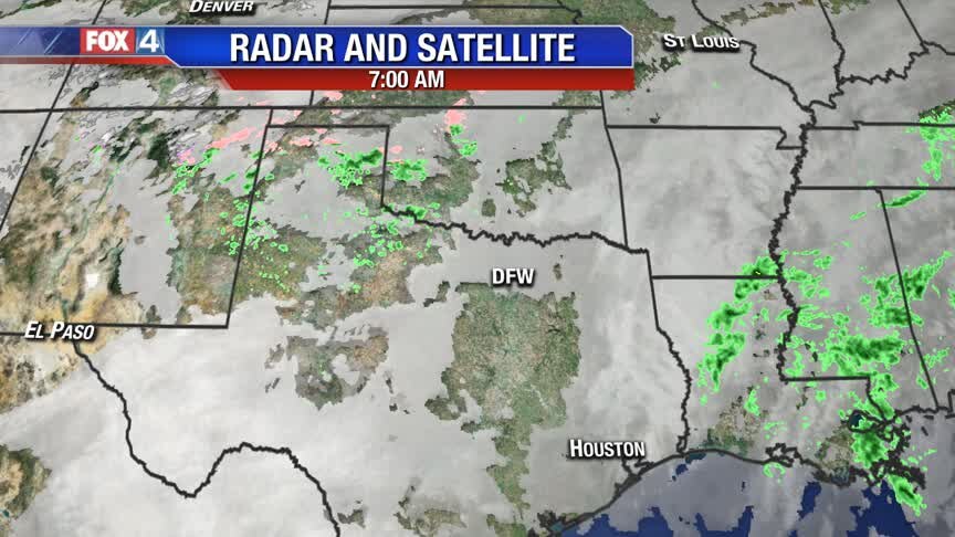
Normal End to 2019!
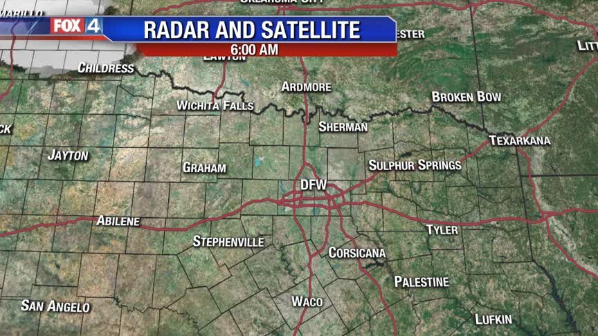
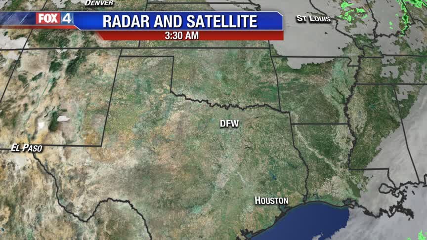
Mainly clear skies and dry conditions continue as we end 2019. The next disturbance returns more clouds and low rain chances to start the New Year.
Mainly clear skies and dry conditions continue as we end 2019. The next disturbance returns more clouds and low rain chances to start the New Year.
"Normal" End to 2019!
Temps in the 50s with dry air and sun to end the year, but we may begin 2020 with more clouds and some low rain chances.
Temps in the 50s with dry air and sun to end the year, but we may begin 2020 with more clouds and some low rain chances.

Cool & Quiet End To 2019!
High pressure takes control across North Texas for the next several days. This means mainly clear skies and seasonably cool temperatures. Expect morning lows in the 30s and afternoon highs in the 50s. By New Year's Day, clouds and low rain chances return ahead of the next disturbance.
High pressure takes control across North Texas for the next several days. This means mainly clear skies and seasonably cool temperatures. Expect morning lows in the 30s and afternoon highs in the 50s. By New Year's Day, clouds and low rain chances return ahead of the next disturbance.
Finally Feels Like North Texas Winter Again
We'll add a dash of sprinkles into today's forecast. Nothing as widespread or heavy as what we saw on Saturday. One thing we will all notice is the cooler temperatures. 2019 ends on a quiet note.
We'll add a dash of sprinkles into today's forecast. Nothing as widespread or heavy as what we saw on Saturday. One thing we will all notice is the cooler temperatures. 2019 ends on a quiet note.
Drying Out & Cooling Down!
Rain comes to an end early this evening. Strong WNW winds usher in drier and slightly cooler air to end the weekend. Expect seasonably cool conditions for the next several days. 2020 starts with another disturbance and rain chances.
Rain comes to an end early this evening. Strong WNW winds usher in drier and slightly cooler air to end the weekend. Expect seasonably cool conditions for the next several days. 2020 starts with another disturbance and rain chances.
Stormy Saturday!
Keep the umbrella handy today! Here's your forecast.
Keep the umbrella handy today! Here's your forecast.

Rain Then Seasonal
Morning showers will be scattered across North Texas, but a line of showers and storms will help nudge the precipitation away by sunset. Clouds will hang around until Sunday morning with temperatures gradually returning back to normal. We look good as we wrap up 2019, but some showers are expected as we begin the new decade.
Morning showers will be scattered across North Texas, but a line of showers and storms will help nudge the precipitation away by sunset. Clouds will hang around until Sunday morning with temperatures gradually returning back to normal. We look good as we wrap up 2019, but some showers are expected as we begin the new decade.
Friday Afternoon Update
Here's a quick look at the afternoon forecast!
Here's a quick look at the afternoon forecast!
1/2 and 1/2 weekend!
Humid air today will lead to more showers and some storms Saturday before gusty, COOL winds take over Sunday! Temps will eventually return to more "normal" end of year levels.
Humid air today will lead to more showers and some storms Saturday before gusty, COOL winds take over Sunday! Temps will eventually return to more "normal" end of year levels.
Warm To Wet
The warmer temperatures will stick around through the start of the weekend, but rain chances do return. Some spotty showers expected Friday late afternoon/evening with most of us remaining dry, but better rain chances await us on Saturday ahead of a cold front. That cold front will bring a line of showers/thunderstorms to the area midday with dropping temperatures in the late afternoon hours. Normal diurnal temperatures return for Sunday and all of next week with highs in the mid 50s.
The warmer temperatures will stick around through the start of the weekend, but rain chances do return. Some spotty showers expected Friday late afternoon/evening with most of us remaining dry, but better rain chances await us on Saturday ahead of a cold front. That cold front will bring a line of showers/thunderstorms to the area midday with dropping temperatures in the late afternoon hours. Normal diurnal temperatures return for Sunday and all of next week with highs in the mid 50s.
Thursday Afternoon Forecast
Not much has changed in the short term forecast. Here's a peek at the afternoon!
Not much has changed in the short term forecast. Here's a peek at the afternoon!
Weekend Changes!
This warm air will yield a LOT more cloudiness next two days and finally some showers and storms for Saturday (nothing too strong). We finish the weekend with gusty, chilly NW winds and near "normal" temps to end 2019!
This warm air will yield a LOT more cloudiness next two days and finally some showers and storms for Saturday (nothing too strong). We finish the weekend with gusty, chilly NW winds and near "normal" temps to end 2019!

Changes on the Way!
Southerly winds will transport low clouds overnight into North Texas. Areas of dense fog are possible mainly south of DFW. Even with mostly cloudy skies, temperatures climb into the 60s and low 70s to end the week. By late Friday, spotty showers return, especially west of the I-35 Corridor. Our next cold front brings widespread showers and some storms Saturday. Behind the front, brisk northwest winds usher in cooler air to end the weekend.
Southerly winds will transport low clouds overnight into North Texas. Areas of dense fog are possible mainly south of DFW. Even with mostly cloudy skies, temperatures climb into the 60s and low 70s to end the week. By late Friday, spotty showers return, especially west of the I-35 Corridor. Our next cold front brings widespread showers and some storms Saturday. Behind the front, brisk northwest winds usher in cooler air to end the weekend.
The Warmth Continues...
South winds are with us through at least Saturday. Sun rules today with highs in low 70s. More clouds Thu-Fri with the next decent rain chance (a few storms) on Saturday.
South winds are with us through at least Saturday. Sun rules today with highs in low 70s. More clouds Thu-Fri with the next decent rain chance (a few storms) on Saturday.

Mild & Dry Santa Forecast
Southerly winds keep North Texas mild through the Christmas Holiday. By the end of the week, the next disturbance returns showers and storms. Highest rain chances exist for Saturday. Behind this next cold front, much cooler air moves in to end the weekend.
Southerly winds keep North Texas mild through the Christmas Holiday. By the end of the week, the next disturbance returns showers and storms. Highest rain chances exist for Saturday. Behind this next cold front, much cooler air moves in to end the weekend.