


Winds of change for the last weekend in April
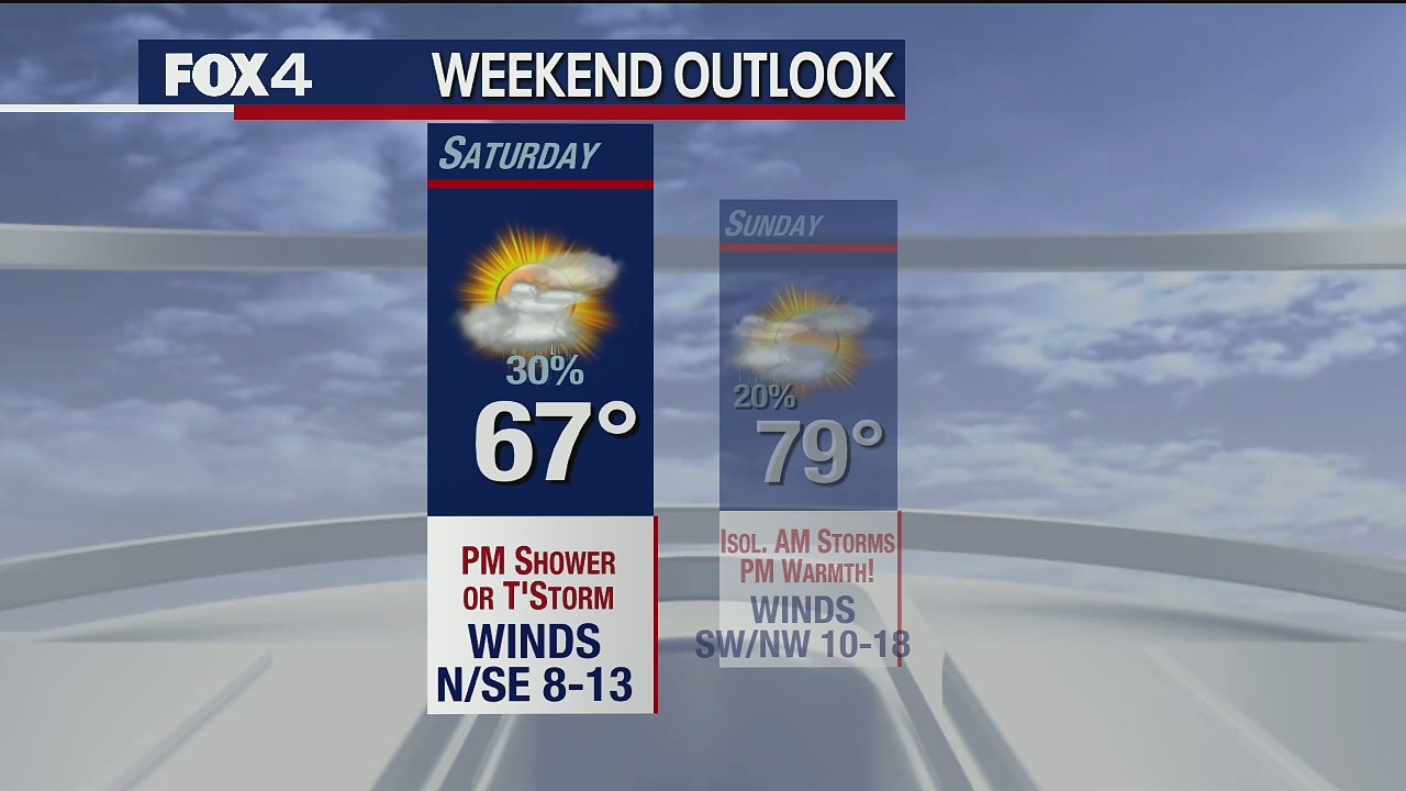
The forecast calls for gusty warm winds today with temperatures in the upper 80s. A cold front may trigger isolated evening storms east of Dallas. Saturday will be breezy and cooler in the mid-70s with some clouds. Sunday looks nice.
The forecast calls for gusty warm winds today with temperatures in the upper 80s. A cold front may trigger isolated evening storms east of Dallas. Saturday will be breezy and cooler in the mid-70s with some clouds. Sunday looks nice.

April 23 overnight forecast
Ali Turiano has the latest forecast.
Ali Turiano has the latest forecast.

April 23 overnight forecast
Dan Henry has the latest forecast.
Dan Henry has the latest forecast.

Superb Spring Sunshine
The best day of the week is today. We'll see dry air, sun and temperatures in the low 80s. It turns windy and very warm Friday as a cold front shifts winds. The weekend will be cooler in the 70s with some clouds Saturday and more sun Sunday. The 80s return next week.
The best day of the week is today. We'll see dry air, sun and temperatures in the low 80s. It turns windy and very warm Friday as a cold front shifts winds. The weekend will be cooler in the 70s with some clouds Saturday and more sun Sunday. The 80s return next week.

April 22 overnight forecast
Dan Henry has the latest forecast.
Dan Henry has the latest forecast.
April 22 evening forecast
Ali Turiano has the latest forecast.
Ali Turiano has the latest forecast.

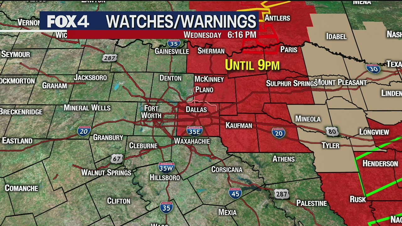
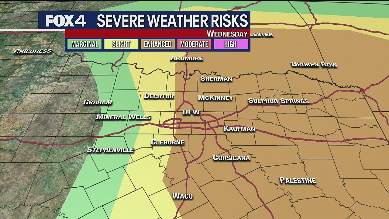
Severe weather possible Wednesday for some in North Texas
Some people in North Texas but not all North Texans will see severe storms Wednesday evening. There are two chances for scattered storms throughout the day -- mid-morning and then again between 3 and 8 p.m. It's that second round that people need to worry about but the coverage is lower.
Some people in North Texas but not all North Texans will see severe storms Wednesday evening. There are two chances for scattered storms throughout the day -- mid-morning and then again between 3 and 8 p.m. It's that second round that people need to worry about but the coverage is lower.

Two rounds of severe weather expected Wednesday across North Texas
Damaging winds up to 60 miles an hour, quarter-sized hail and an isolated tornado are all possible
Damaging winds up to 60 miles an hour, quarter-sized hail and an isolated tornado are all possible
April 21 afternoon forecast
Dan Henry has the latest forecast.
Dan Henry has the latest forecast.

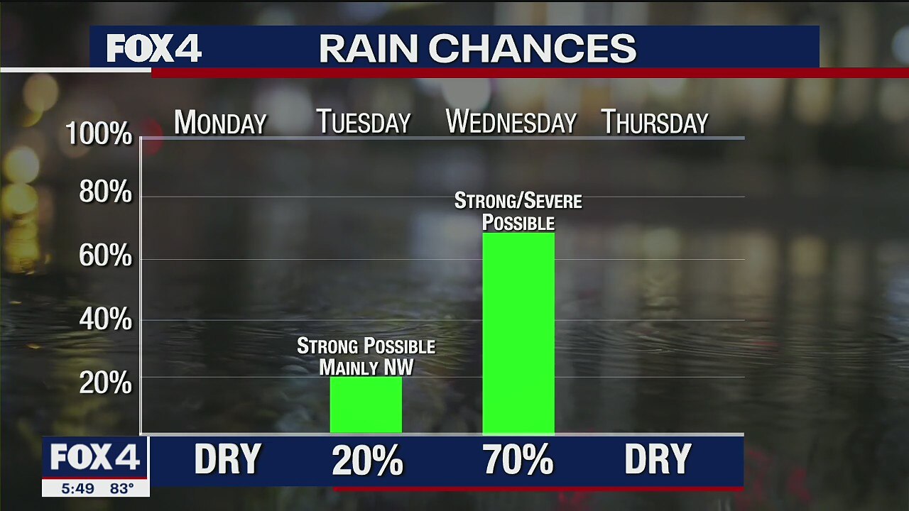
Waiting on storms... enjoying the warmth
It will be a bit warmer today with highs in the low 80s. An isolated shower can't be ruled out. Wednesday could see some strong storms in the morning (50%) with additional storms late in the day (30%), including some that are severe.
It will be a bit warmer today with highs in the low 80s. An isolated shower can't be ruled out. Wednesday could see some strong storms in the morning (50%) with additional storms late in the day (30%), including some that are severe.

April 20 overnight forecast
Ali Turiano has the latest forecast.
Ali Turiano has the latest forecast.

April 20 afternoon forecast
Ali Turiano has the latest forecast.
Ali Turiano has the latest forecast.

Typical April weather returns
Today is going to feel more like April. That means warm with some storms. The morning clouds and patchy fog will break for a little sun and temperatures in the upper 70s. Then there are low storm chances tonight into early Tuesday.
Today is going to feel more like April. That means warm with some storms. The morning clouds and patchy fog will break for a little sun and temperatures in the upper 70s. Then there are low storm chances tonight into early Tuesday.
Spring-like Temperatures This Week
We will see Spring-like temperatures this week, and that means chances for storms as well.
We will see Spring-like temperatures this week, and that means chances for storms as well.

Small Chance of Rain on Sunday
Ali has a look at the rain chance on Sunday.
Ali has a look at the rain chance on Sunday.

April 17 overnight forecast
Dan Henry has the latest forecast.
Dan Henry has the latest forecast.
Chance of Rain This Weekend
Small chances of rain over the weekend
Small chances of rain over the weekend

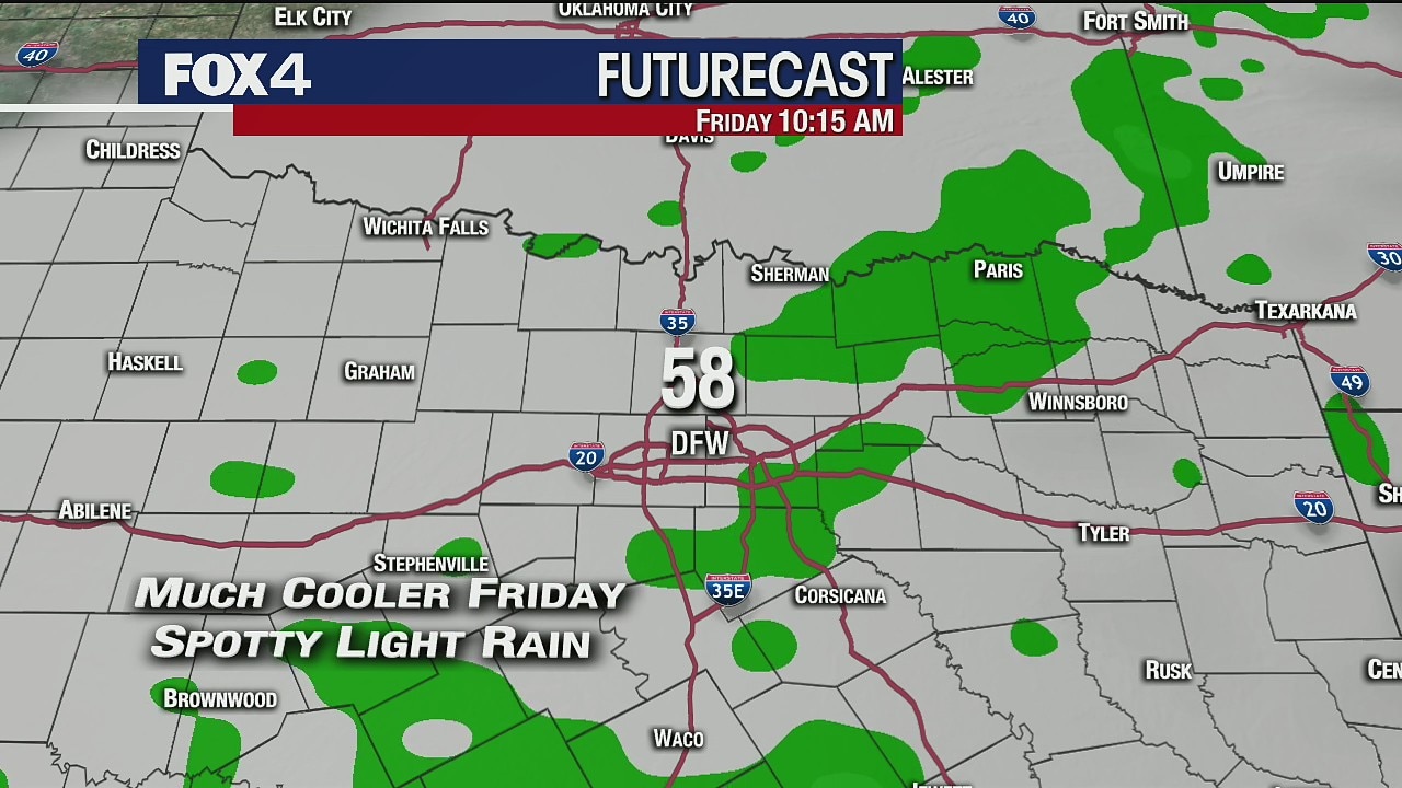
Cold front blows through on Friday
A strong cold front will blow through this morning, with temps falling into the 50s this afternoon. Light rain & drizzle will accompany the front. Our active weather pattern continues this weekend. Showers and storms return tomorrow afternoon.
A strong cold front will blow through this morning, with temps falling into the 50s this afternoon. Light rain & drizzle will accompany the front. Our active weather pattern continues this weekend. Showers and storms return tomorrow afternoon.

April 16 overnight forecast
Dan Henry has the latest forecast.
Dan Henry has the latest forecast.
April 16 overnight forecast
Dan Henry has the latest forecast.
Dan Henry has the latest forecast.