

Dallas weather: Flood risk increases as heavy rain and storms move into North Texas

DALLAS - While the severe weather threat is waning, flood risks are increasing across North Texas. Two more rounds of rain and storms will move through for the rest of the work week before a dry, cool weekend.
Thursday Forecast
Dallas weather: Apr. 30 morning forecast
There's no severe weather expected today, but a few storms will still hit the Metroplex. Meteorologist Ali Turiano has your forecast.
Scattered showers and storms are likely Thursday. A few stronger storms are possible, primarily south of the Metroplex, with highs in the mid-60s. While the severe threat remains low, storms southwest of DFW could produce small hail, frequent lightning and locally heavy rain.
Residents in these areas should remain weather aware. Stay indoors to avoid lightning, never drive through flooded roadways and be prepared to alter outdoor plans.
Weekend Forecast
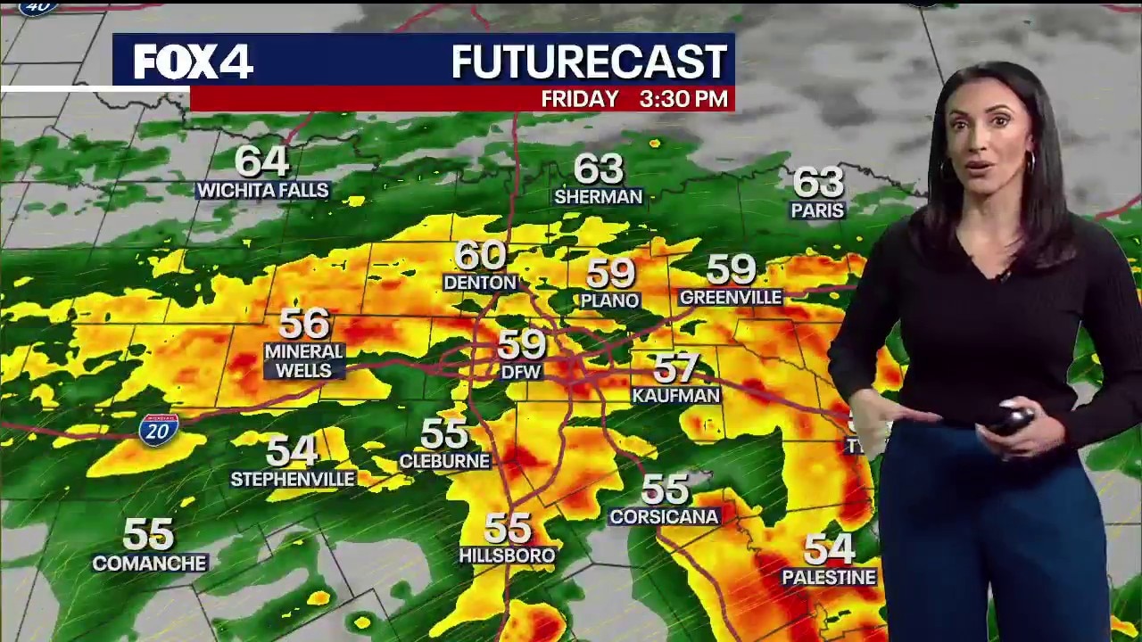
A final round of widespread heavy rain is expected Friday, with temperatures struggling to reach the upper 50s and low 60s. While severe weather is unlikely in North Texas, isolated strong storms could occur. Use extra caution at low water crossings and in areas with poor drainage.
Conditions will dry out just in time for the weekend. Expect cool mornings and pleasant, sunny afternoons with highs in the 70s on Saturday and Sunday. Saturday night will be chilly, with lows dropping into the upper 40s and lower 50s under clear skies. Sunday will see a high near 80.
7-Day Forecast

A warming trend begins next week, with temperatures returning to above-normal levels.
NWS Confirms 5 Tornadoes Hit North Texas
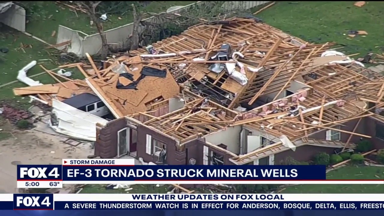
Mineral Wells recovers after EF-3 tornado ravages city
Industrial areas and homes in Mineral Wells were ravaged by an EF-3 tornado on Tuesday evening, and five people were injured during the severe weather. FOX 4's Alex Boyer has more on the city's recovery efforts.
The National Weather Service has confirmed at least five tornadoes touched down in North Texas during Tuesday’s severe weather outbreak.
Mineral Wells (EF-3) A survey team from the NWS office in Fort Worth confirmed an EF-3 tornado with peak winds of 145 mph struck Mineral Wells around 5 p.m. Tuesday. The tornado formed along Highway 180, leveling warehouses in the city's industrial region and ripping roofs off homes. Officials are urging the public to avoid the area as it remains unsafe. The city is still determining when displaced residents can return. No fatalities were reported, though several people were hospitalized.
Cleburne and Rio Vista (EF-0 and EF-1) Two tornadoes were produced by a single storm cell that tracked from Cleburne to Rio Vista. West of Cleburne, an EF-0 tornado with 80 mph winds touched down in Byron Stewart Park. It traveled 3.5 miles, crossing Lake Pat Cleburne and destroying trees and an RV storage garage. The same cell later produced an EF-1 tornado with 90 mph winds in Rio Vista. This two-mile path damaged homes, businesses, and metal structures near FM 916, though no major injuries were reported.
Cresson and Montague County The NWS also confirmed a brief tornado on the east side of Cresson. Because a clear damage path could not be determined, it currently holds an "N/A" rating pending further investigation. Additionally, video evidence confirmed a brief tornado east of Highway 59 near the Clay County line in Montague County. Information there remains limited to reported tree damage.
The NWS noted that all ratings are preliminary and may change as survey teams finalize their investigations.
LIVE Radar: Dallas-Fort Worth

The Source: Information in this article comes from the National Weather Service and the FOX 4 Weather Team.