

Chance of severe weather for much of North Texas Wednesday night

The chance of severe weather returns for much of North Texas Wednesday night.
A Severe Thunderstorm Watch has been issued until 10 p.m. for the northern counties of the Metroplex, while a Tornado Watch has been issued for the counties south of Dallas and Tarrant until 10 p.m.
The biggest risk for severe weather is in areas south and southeast of Dallas, with that portion having a marginal severe weather risk. The rest of North Texas has a slight or marginal risk of severe weather.
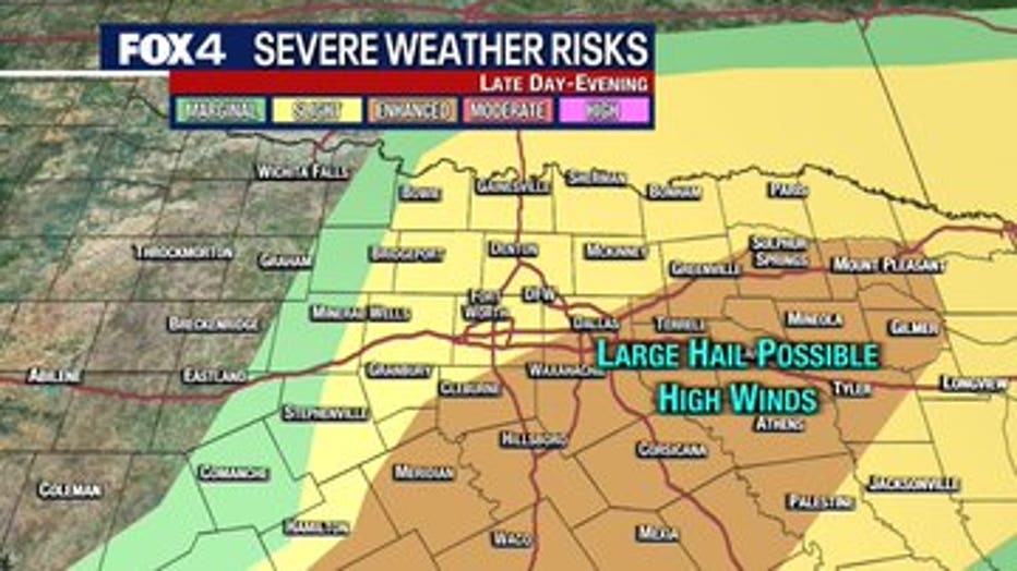
The biggest threat from these storms are rain, hail, high winds, and slight chances for an isolated tornado. The hail could be up to quarter-sized.
The first round of storms will develop west and southwest of I-35, before moving northeast as we get closer to sunset.
The most active period for the first round of storms is expected to be from 6-8 p.m. and into the late night hours.
Then, overnight, there could be a second round of storms that bring a hail and high wind threat.
RELATED: