

Dallas Weather: Storm risks increase in DFW, bringing tornado and hail risks

Dallas weather: Severe weather possible Tues., Wed.
FOX 4 meteorologist Ali Turiano takes a look at the severe weather that could move through our area on Tuesday and Wednesday.
DALLAS - Storm risks are on the rise this week across North Texas, with Wednesday shaping up to be the day for severe weather, including tornadoes, damaging winds and hail.
Tuesday Forecast
Tuesday will be warm, humid and breezy, with afternoon sunshine expected as clouds begin to break. Highs will reach the 80s. Rain chances remain low, though a few isolated showers are possible.
A stronger disturbance moves in late Tuesday evening, bringing a risk of storms west of the DFW area. These storms, which could produce wind and hail, are expected between sunset and midnight.

Wednesday Forecast
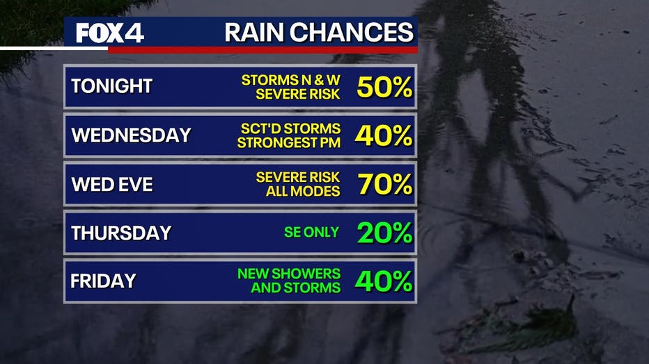
Wednesday is the main day to watch for severe weather. Storms may develop as early as the morning and continue through midday, but the greatest risk arrives later in the afternoon and evening.
Initial storms could bring tornadoes along with damaging winds and large hail. The threat is expected to last into the overnight hours.
7-Day Forecast

The upper-level system will move out Thursday, bringing warmer temperatures and increasing sunshine.
Another disturbance may approach Friday, possibly triggering additional storms. However, severe weather is not expected. More cloud cover on Friday will likely keep highs in the mid to upper 70s.
Looking ahead to the weekend, temperatures will remain in the upper 70s to low 80s, with low chances for showers — a return to typical May weather.
The Source: Information in this article comes from the National Weather Service.