

Dallas weather: Severe storms target DFW overnight ahead of Election Day
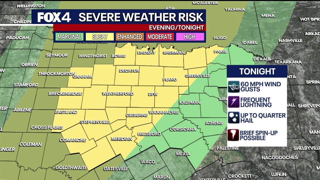
DALLAS - A weather system that caused historic flooding across the Southwest is heading toward North Texas.
Severe Weather Risk and Timing
What we know:
Storms will begin developing to the north and west between 4 p.m. and 6 p.m. this evening. The system will move closer to the I-35 corridor by 10 p.m.
The primary threat is damaging wind gusts up to 60 mph, which can cause damage similar to a weak tornado.
Large hail, up to the size of quarters, and localized flooding are also possible.
Temperatures will drop from a high of 85 degrees today to about 73 degrees behind the cold front.
Radar: Dallas - Fort Worth

Local perspective:
The rain is expected to move out of the immediate Dallas-Fort Worth Metroplex by the early morning commute at 4 a.m.
Voters in eastern and southeastern counties, stretching into East Texas, may still see rain when polls open around 7 a.m.
Voters in eastern areas might consider waiting until the afternoon to cast their ballots, as the region will dry out quickly once the front passes.
What's next:
Following the storms, strong north-west winds up to 25 mph will dry out the area quickly.
The rest of the week will have seasonal, comfortable conditions with highs in the 70s.
The region will remain mostly rain-free, aside from a low rain chance along the Red River on Thursday.
7-day Forecast

The Source: The information in this article comes from FOX 4's Ali Turiano.