

Dallas weather: Dense fog shrouds Texas ahead of severe storms and cold front
Dallas weather: November 1 morning forecast
All eyes are on Monday night into Tuesday for a cold front to move in, bringing breezy winds, rain and rumbles, and eventually cooler temperatures.
DALLAS - Dense fog advisories greeted residents across parts of Texas and Oklahoma on Sunday morning, marking the start of a volatile weather pattern expected to bring severe thunderstorms to North Texas early this week before a cold front delivers seasonal autumn temperatures.
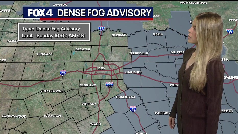
Dense Fog Advisories
The National Weather Service issued dense fog advisories for areas extending from the Texas Panhandle through East Texas, including Rockwall, Kaufman, and Hunt counties east of Interstate 45. While the Dallas-Fort Worth metroplex remained outside the formal advisory area, high moisture levels and low cloud cover reduced visibility across the region. The advisories were set to expire at 10 a.m. Sunday.
A ground stop has been issued at DFW Airport until at least 8 a.m.
Weather sensors recorded temperatures of 60 degrees in Dallas and Fort Worth on Sunday morning, with Dallas Love Field reporting 64 degrees. Matching dew points indicated fully saturated air accompanied by calm winds, creating prime conditions for fog.
We are monitoring a low-pressure system currently generating rain, snow showers, and mountain activity across the Four Corners region. The system is projected to move east over the next 24 hours, bringing a cold front across Texas from west to east.
Will it rain Monday?
Precipitation chances begin Monday afternoon with a 20% coverage of pop-up showers, increasing to 60% Monday night into early Tuesday morning as the main squall line arrives. Coverage is expected to diminish to 30% by Tuesday afternoon as the front moves eastward.
Severe storm threat Monday night
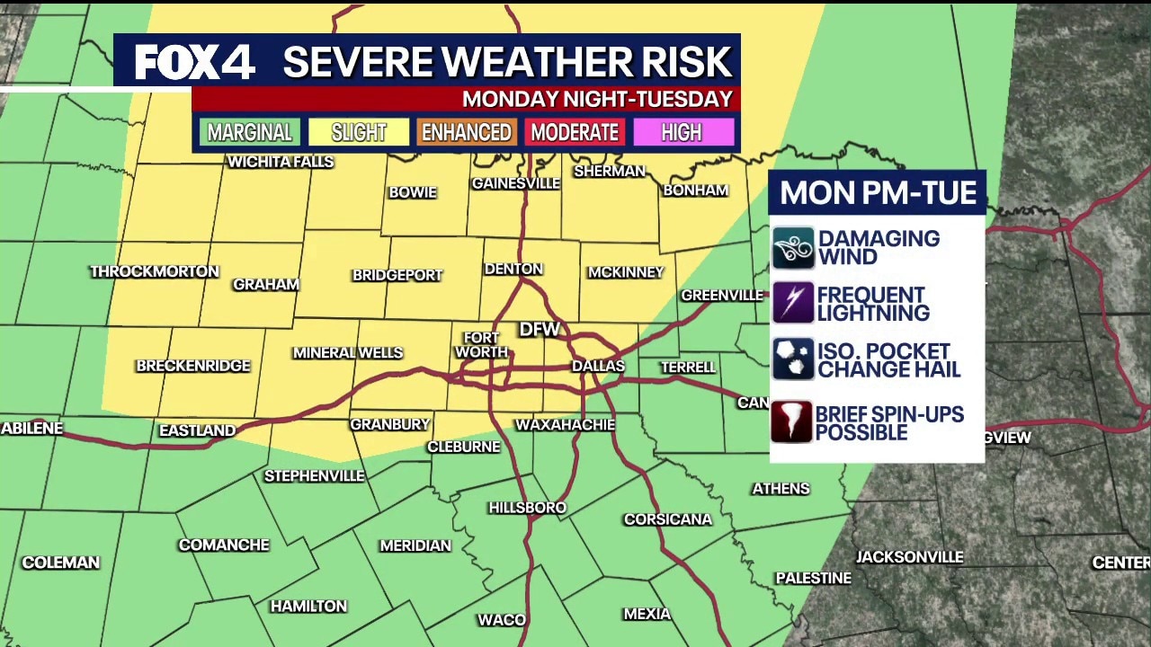
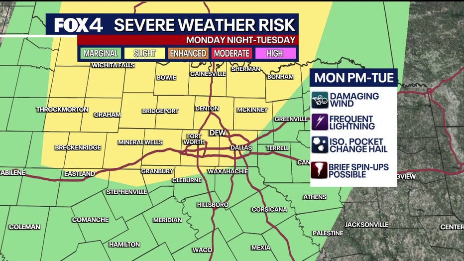
The Storm Prediction Center has placed much of North Texas under a severe weather risk for Monday night into Tuesday, extending across the southern and central Plains down to the Texas Big Bend. The metroplex and surrounding counties face a slight risk (level 2 of 5) to marginal risk (level 1 of 5) for severe weather along the leading edge of the front.
Primary hazards include damaging straight-line winds, frequent lightning, hail, and the potential for brief tornado activity along the boundary line. Brief localized flooding is also a concern, with forecasting models favoring the metroplex and eastern counties to receive localized downpours of 1.5 to 2 inches of rain.
Weather on Election Day
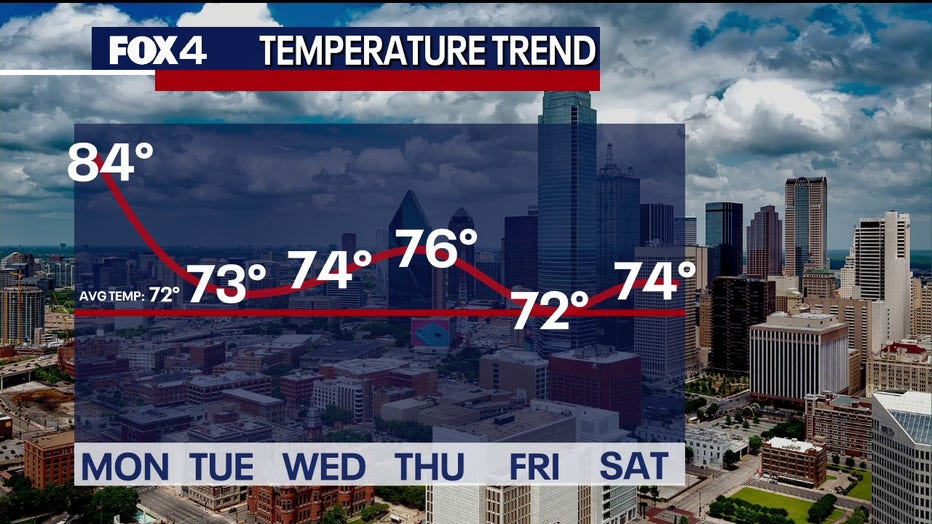
Following the front's passage, weather conditions are expected to improve significantly. Midterm Election Day on Tuesday is projected to clear out well before midday, leaving afternoon temperatures in the low-to-mid 70s under clearing skies.
Wednesday is expected to be the standout day of the week, featuring mostly sunny skies and mid-70s temperatures. A secondary cold front arriving late Thursday will reinforce northerly winds, bringing daytime highs down into the upper 60s and lower 70s by Friday—aligning with typical seasonal averages for early November.
The upcoming weekend forecast calls for clear, seasonable conditions, with morning lows in the 50s and afternoon highs in the lower 70s.
7-Day Forecast

The Source: Information in this article is from the FOX 4 weather team.