

Dallas weather: Severe Thunderstorm Watch in effect on Friday night
DALLAS - Warm, muggy conditions will dominate the next few days in North Texas as the risk of severe storms makes a comeback.
Some storms have started to form, a tornado warning for Navarro County earlier in the evening expired.

Large hailstones fall in Dallas-Fort Worth metroplex
Large hail has been reported in the Dallas-Fort Worth metroplex Friday night.
Any storms that do pop could produce damaging winds and large hail.
Severe Thunderstorm Watch
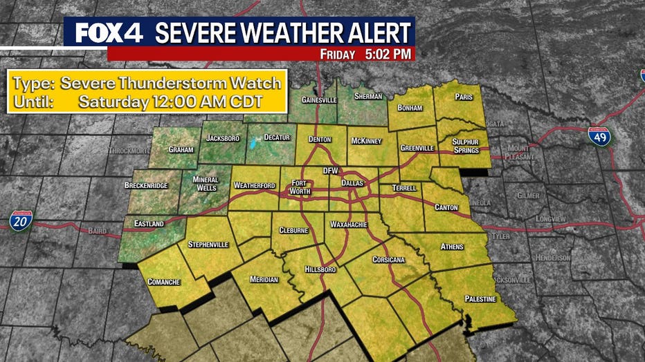
A Severe Thunderstorm Watch has been issued for the area until midnight.
Friday Forecast
Dallas weather: May 16 evening forecast
Dallas-Fort Worth local news, traffic, sports and more presented by the FOX 4 News Team.
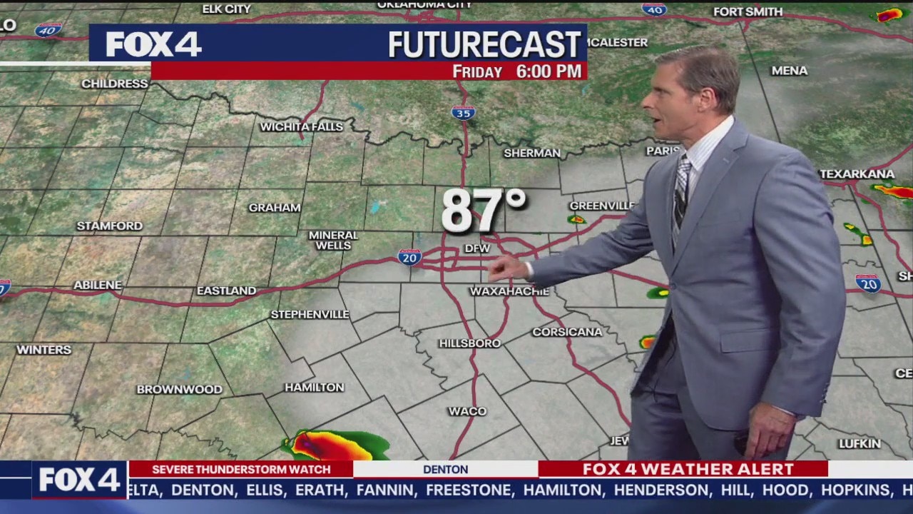
Friday’s forecast is a bit tricky. Morning clouds will gradually clear, allowing temperatures to climb into the low 90s. By late afternoon, dry air moving east will trigger scattered thunderstorms. Storm development is expected after 4 p.m., especially near the Metroplex. Coverage will be greater to the east and south of Dallas-Fort Worth.
Large hail and damaging winds are the primary threats.
Live Radar

Weekend Forecast
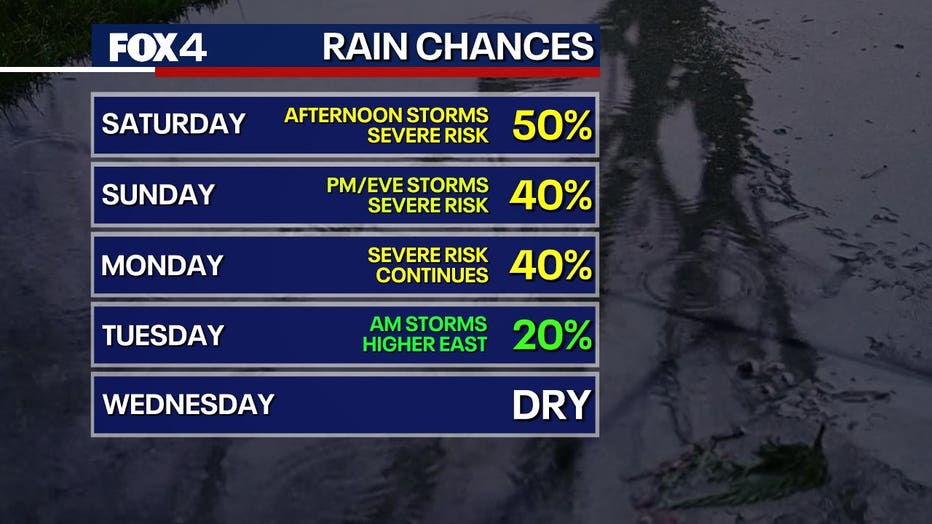
The dryline will retreat Saturday morning, leaving behind warm, humid and cloudy conditions. Temperatures will rise to near 90 degrees with light southerly winds. A stronger disturbance will arrive in the afternoon.
Storms are expected to form west of the Metroplex after 2 p.m. and taper off by around 8 p.m. on Saturday. These storms may bring large hail and high winds. While the tornado threat is low, it's not zero—stay weather aware.
Sunday will remain warm, breezy and humid, with another storm system arriving late in the evening.
7-Day Forecast

Storm chances linger into Monday as unstable air sticks around. The system will finally move out Tuesday afternoon, though a few lingering showers are possible earlier in the day, mainly to the east.
By Wednesday, expect mostly sunny skies with highs in the upper 70s to low 80s.
The Source: Information in this article comes from the National Weather Service.