


Sunday Evening Forecast
Widespread showers/storms arrive overnight...here's your forecast!
Widespread showers/storms arrive overnight...here's your forecast!

Dreary Saturday Evening!
Keep the umbrella handy if you have plans tonight...off and on showers will continue!
Keep the umbrella handy if you have plans tonight...off and on showers will continue!

Rain Chances Continue...
Keep the umbrella handy today! Here's your forecast.
Keep the umbrella handy today! Here's your forecast.

Wet Morning For North Texas!
Grab the umbrella today! Here's your forecast.
Grab the umbrella today! Here's your forecast.

Thursday Afternoon Forecast
Shower and storm chances return today...here's an update.
Shower and storm chances return today...here's an update.

Few Storms Possible
Storm chances return to the forecast today, and some could be on the strong side. Here's your Thursday forecast.
Storm chances return to the forecast today, and some could be on the strong side. Here's your Thursday forecast.

Storm Chances Go Up!
Isolated strong to severe storms are possible starting late Thursday afternoon. Gusty winds and hail will be possible in the strongest storms. The long-awaited disturbance out west gets to Texas, increasing our rain chances to end the week. The unsettled weather pattern will likely continue through the first half of next week.
Isolated strong to severe storms are possible starting late Thursday afternoon. Gusty winds and hail will be possible in the strongest storms. The long-awaited disturbance out west gets to Texas, increasing our rain chances to end the week. The unsettled weather pattern will likely continue through the first half of next week.

Wednesday Afternoon Forecast
Here's a look at your warm & humid afternoon forecast!
Here's a look at your warm & humid afternoon forecast!

Wednesday Morning Forecast
Feeling like Spring this morning! We're warm & humid, with highs this afternoon expected in the low 80s. Rain/storm chances are isolated today and tomorrow but become widespread by the end of the week into the weekend.
Feeling like Spring this morning! We're warm & humid, with highs this afternoon expected in the low 80s. Rain/storm chances are isolated today and tomorrow but become widespread by the end of the week into the weekend.

Stormy End to the Week!
Spring-like temperatures and an active weather pattern continue through the week. Widespread showers and storms are expected Friday and Saturday.
Spring-like temperatures and an active weather pattern continue through the week. Widespread showers and storms are expected Friday and Saturday.

Feeling like early "spring"!
Temps stay warm until later this week when rain and storm chances are on the rise into the weekend.
Temps stay warm until later this week when rain and storm chances are on the rise into the weekend.

Active Weather Pattern!
The overall weather pattern remains unsettled through the week. Expect low rain chances through Thursday, with a stronger disturbance bringing widespread rain and storms by the end of the work week and into the weekend.
The overall weather pattern remains unsettled through the week. Expect low rain chances through Thursday, with a stronger disturbance bringing widespread rain and storms by the end of the work week and into the weekend.

Mild, Muggy Week
Very warm temperatures this week with humid conditions. A few isolated showers will miss DFW Tuesday and Wednesday, but the best rain chances for most of North Texas will be Friday and Saturday. The weather late this week will be very conditional, meaning if the conditions are right we may see more thunderstorms than showers come Friday. Stay tuned as this forecast will likely deviate throughout the week, especially with the weekend temperatures.
Very warm temperatures this week with humid conditions. A few isolated showers will miss DFW Tuesday and Wednesday, but the best rain chances for most of North Texas will be Friday and Saturday. The weather late this week will be very conditional, meaning if the conditions are right we may see more thunderstorms than showers come Friday. Stay tuned as this forecast will likely deviate throughout the week, especially with the weekend temperatures.

Warm Week...Showers Possible
Shower this morning, should exit...and 70s take over. Even 80+ by mid-week before a stronger system heads in to end the week.
Shower this morning, should exit...and 70s take over. Even 80+ by mid-week before a stronger system heads in to end the week.

Unsettled Week Ahead!
Several disturbances moves through North Texas this week, keeping rain chances in place each day. Overnight showers move in from the west and will linger through Monday morning. Lower chances for rain and storms exist mid-week, before a stronger disturbance brings widespread rain and potentially strong storms on Friday.
Several disturbances moves through North Texas this week, keeping rain chances in place each day. Overnight showers move in from the west and will linger through Monday morning. Lower chances for rain and storms exist mid-week, before a stronger disturbance brings widespread rain and potentially strong storms on Friday.

A Cloudy & Mild Sunday
We stay dry today, with plenty of cloud cover and highs expected in the 60s. A few showers return to the forecast overnight, with active weather expected all week.
We stay dry today, with plenty of cloud cover and highs expected in the 60s. A few showers return to the forecast overnight, with active weather expected all week.

Unsettled Weather Pattern
An unsettled weather pattern sets up across North Texas in the coming days. Expect Spring-like temperatures and rain chances increasing. The first disturbance moves through Sunday night into Monday. Higher coverage of rain and storms is likely by the end of the work week.
An unsettled weather pattern sets up across North Texas in the coming days. Expect Spring-like temperatures and rain chances increasing. The first disturbance moves through Sunday night into Monday. Higher coverage of rain and storms is likely by the end of the work week.
Weekend Forecast!
Clouds this morning, with a nice mix of sun and clouds this afternoon. Highs will climb into the 60s both today and tomorrow, with shower chances returning late tomorrow night.
Clouds this morning, with a nice mix of sun and clouds this afternoon. Highs will climb into the 60s both today and tomorrow, with shower chances returning late tomorrow night.
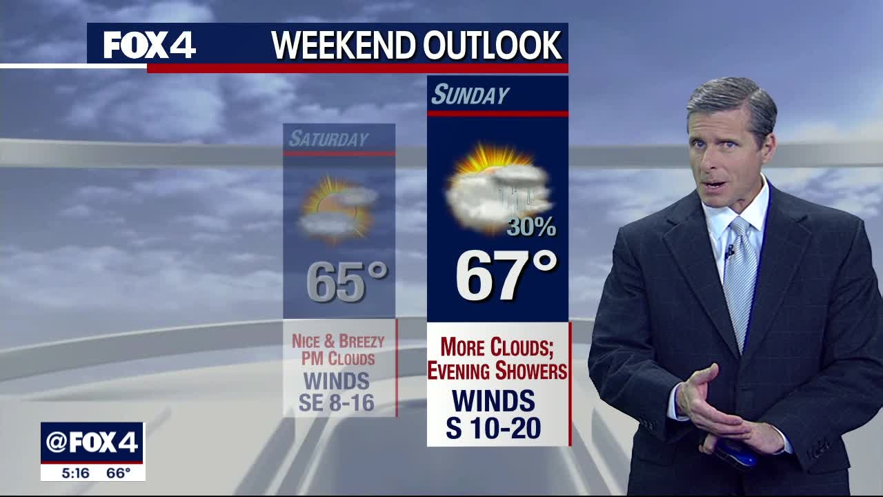
Nice Weekend
Overall a quiet and pleasant weekend, we do have some rain chances late Sunday. Our seasonal 60s jump straight into the upper 70s for a good portion of next week. We'll be waiting for better rain chances as well.
Overall a quiet and pleasant weekend, we do have some rain chances late Sunday. Our seasonal 60s jump straight into the upper 70s for a good portion of next week. We'll be waiting for better rain chances as well.

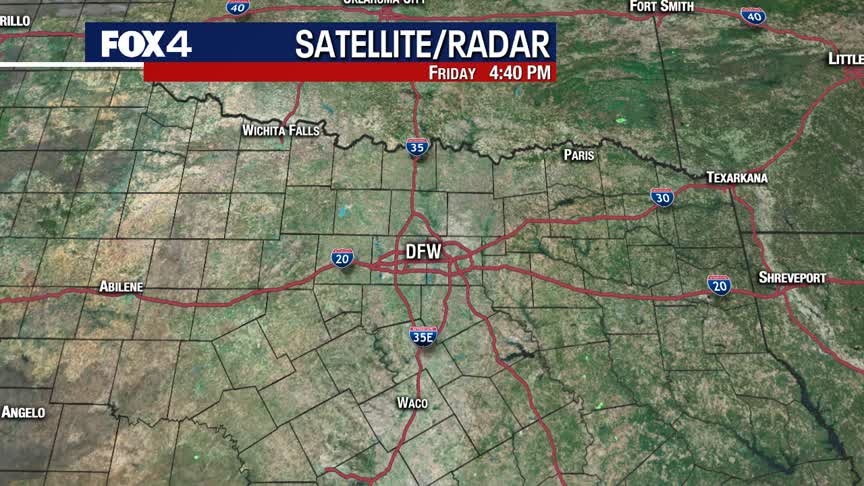
Cool Friday Morning...
A weak cold front rolled through yesterday, so we're waking up to chilly conditions this morning. Highs will be several degrees below yesterday's...likely staying in the mid 60s.
A weak cold front rolled through yesterday, so we're waking up to chilly conditions this morning. Highs will be several degrees below yesterday's...likely staying in the mid 60s.