

Dallas Weather: Warnings settle for Dallas-Fort Worth as strong storms move across
Dallas weather: June 6 overnight forecast
FOX 4's Josh Johns gives the latest weather forecast for much of North Texas as severe storms briefly swept through the region.
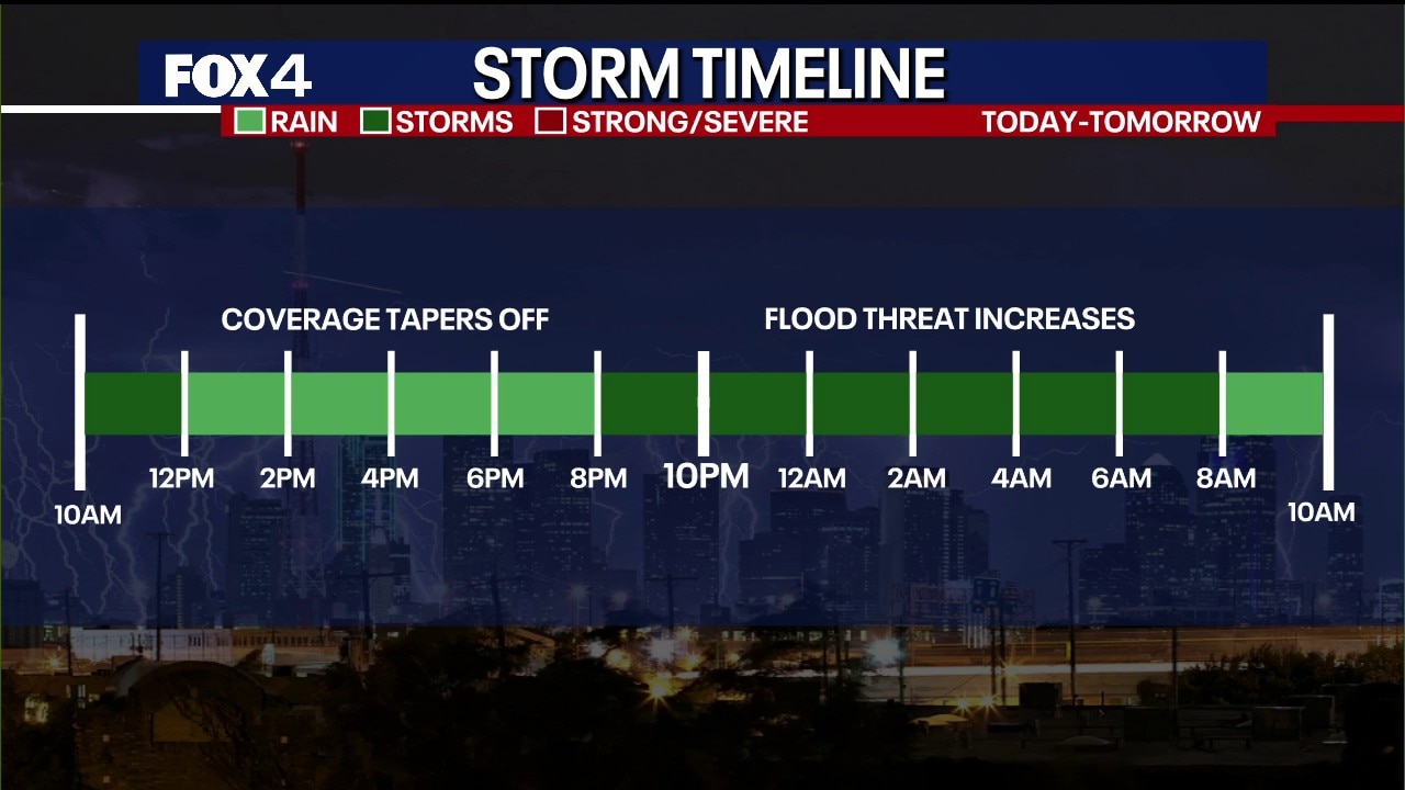
DALLAS - Residents across North Texas should remain weather aware Saturday evening as multiple rounds of thunderstorms continue to move across the region, bringing the threat of damaging wind gusts, frequent lightning and pockets of heavy rainfall.
Saturday Night Forecast

A Severe Thunderstorm Warning was issued for parts of Dallas and Ellis counties Saturday evening as a strong line of storms pushed northeast through the southern Dallas-Fort Worth Metroplex.
The strongest storm developed near Mansfield before moving toward Cedar Hill, DeSoto, Oak Cliff and downtown Dallas. Meteorologists said the storm was initially capable of producing wind gusts between 60 and 65 mph, though radar indicated some weakening as it approached Dallas County.
Heavy rain and frequent lightning accompanied the storms, with numerous cloud-to-ground lightning strikes detected around Joe Pool Lake and southern Dallas County. The National Weather Service warned that isolated hail up to penny size and wind gusts up to 60 mph remained possible.
Forecasters tracked the strongest storms moving from southwest to northeast at roughly 30 mph, bringing periods of torrential rainfall to communities across the Metroplex.
Dallas weather: June 6 morning forecast
Saturday is off to a rainy start for most of North Texas! More activity is expected throughout the weekend. Flood Watches remain in effect through Sunday afternoon.
Additional storms developing
The warned storm was just one of several thunderstorms moving through North Texas Saturday evening.
Another cluster of storms stretched from Bosque County through Somervell County and toward Hill County, producing heavy rainfall from Glen Rose to Meridian and Cranfills Gap. That activity was expected to continue northeast toward Hillsboro and Waxahachie through the evening hours.
Meanwhile, scattered downpours continued across portions of Dallas, Collin, Rockwall and Hunt counties, although rainfall was gradually diminishing in some northern communities.
Heavy rain and localized flooding threat
Dig deeper:
While the severe thunderstorm threat has centered on damaging winds, heavy rainfall remains a concern in areas repeatedly impacted by storms.
Radar estimates showed several locations receiving between 1 and 2 inches of rain in a relatively short period, with isolated pockets exceeding those amounts. Rainfall rates within the strongest storms could briefly overwhelm drainage systems and lead to localized street flooding.
The flooding threat is expected to remain localized rather than widespread, but motorists are encouraged to use caution when encountering water-covered roadways.
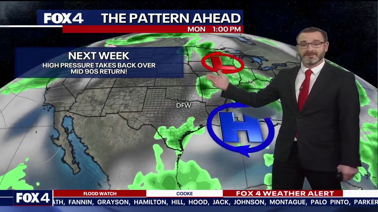
Look Ahead

What's next:
Thunderstorm chances will continue through the evening and overnight hours as additional disturbances move across North Texas. While not every community will experience severe weather, any storm that develops could produce gusty winds, dangerous lightning and brief periods of torrential rainfall.
Residents are encouraged to monitor watches and warnings throughout the evening, especially across the Dallas-Fort Worth Metroplex, where storms continue to move northeast through the region.
The Source: Information in this article was provided by the FOX 4 Weather Team.