

Dallas weather: Extreme Cold Watch issued for Tuesday through Thursday

Dallas weather: Feb. 16 evening forecast
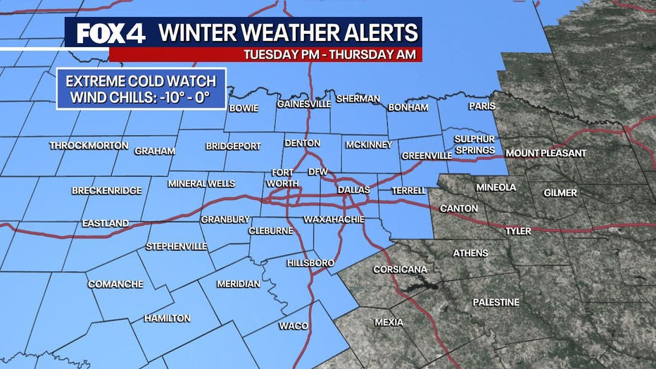
FOX 4's Dylan Federico explains the Extreme Cold Watch in North Texas this week.
DALLAS - An Extreme Cold Watch has been issued for North Texas from Tuesday night through Thursday as we could see record cold.
North Texas' first cold front moved through Saturday night, and then the real cold front comes as we head into Tuesday.
Temperatures are expected to fall well below freezing with a wind chill that could be as cold as -10 degrees in some areas!
Sunday Forecast: Light freeze overnight
Timeline:
Cold temperatures will falling down to the upper 20s to lower 30s here in the Metroplex. Outside of DFW temperatures will be in the mid to upper 20.
A light freeze is expected area-wide.
It is not expected to be cold enough to freeze your pipes, but it doesn't hurt to keep the faucet on a drip if you want.
Monday Forecast: Warmer temperatures
Timeline:
Monday will be slightly warmer.
We will be back up into the mid 50s for the most part and there will be lots of sun.
President's Day will be a decent day to get out and do things this week.
Tuesday Forecast: Cold front moves in
Timeline:
We will start off the day in the 40s on Tuesday, but temperatures will drop.
An Arctic front is expected to move through the area on Tuesday night.
We expect to see a cold rain earlier in the day on Tuesday and it should transition over to a wintry mix or light freezing rain or freezing drizzle heading into Tuesday evening for some in North Texas. A light glaze of ice is possible on the roadways with this. This is something we'll have to monitor as we get into Tuesday.
The real story is the cold air that comes behind it. It could be the coldest of this winter.
An Extreme Cold Watch will go into place starting Tuesday night.
Wednesday Forecast: Frigid temperatures
Timeline:
You will wake up on Wednesday morning to some of the coldest temperatures we have seen this season.
There could be a few slick spots on the roads on Wednesday morning.
The wind chill on Wednesday morning will be near zero or below zero in many sports.
Some spots could see them as cold as negative 10 degrees.
Wind chills will struggle to get out of the teens on Wednesday.
The cold will be dangerous, and you should take all freeze precautions to protect your pipes, plants, people and pets.
Thursday Forecast: Possible record cold
Timeline:
We could see a record low on Thursday morning.
The record low for Feb. 20 at DFW Airport is currently 19 degrees.
Right now, we believe the low will fall to 16 degrees.
7-Day Forecast

Temperatures are expected to warm up a bit after Thursday, but just a bit.
Lows are below freezing on both Friday and Saturday, but the highs will climb above the 32-degree mark.
The Source: Information in this article comes from the FOX 4 Weather team.