

Slow-moving storms dump up to 6 inches of rain across DFW, triggering flash flooding
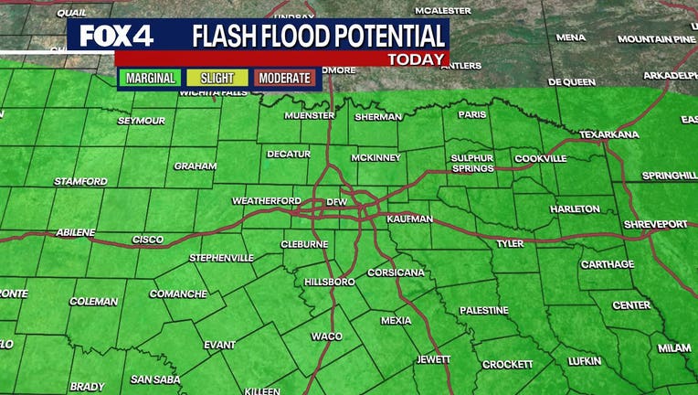
DALLAS - Slow-moving thunderstorms could dump up to 6 inches of rain across parts of the Dallas-Fort Worth Metroplex on Monday, triggering flash flood warnings, water-logged commutes, and a welcome, if temporary, break from triple-digit heat.
Flash Flood Warnings
A flash flood warning remains in effect until 10:15 a.m. for Tarrant County as torrential downpours are catching drivers during the morning rush hour. Please avoid flooded roadways. Standing water is rapidly pooling in low-lying and poor drainage areas.
A Flash Flood Warning has also been issued for Henderson and Navarro Counties until 11 a.m.
A Flash Flood Warning has been issued for Smith County until 11:15 a.m.
LIVE RADAR
The heaviest rainfall was around Lewisville, which emerged as the morning's "bullseye" with staggering totals between 5 and 6 inches before the precipitation began to taper off. Nearby White Settlement recorded between 3 and 4 inches of rain, while North Richland Hills saw closer to 3 inches in a short span of time.
As the primary storm cell drifted slowly to the east, flood advisories were issued for Denton, Collin, Navarro, and Henderson counties.
While the storms are bringing frequent lightning strikes to Burleson, Arlington, and Fort Worth, no severe weather has been reported. However, the sluggish pace of the system means that the threat of localized flooding will persist as the rain nudges into Dallas County and Van Zandt County.
The multi-day rain event is being driven by a weak weather boundary stalling over North Texas, paired with a meandering upper-level disturbance.
The silver lining to the soggy start to the week is a significant drop in temperatures. After enduring triple-digit heat last week, the Metroplex can expect highs to cap out in the upper 80s to low 90s through midweek due to persistent cloud cover and rain.
The highest coverage of rain will remain over the Metroplex through Monday morning before shifting south of the Interstate 20 corridor on Tuesday and Wednesday. While Tuesday morning commutes are expected to be dry, afternoon thunderstorms are anticipated to redevelop, particularly in central Texas.
7-Day Forecast

The break from the intense summer heat will be short-lived. As the region dries out late in the week, sunshine will return to crank temperatures back up into the upper 90s by Sunday.
The Source: Information in this article is from the FOX 4 weather team.