North Texas upgraded to 'Moderate Risk' for severe weather Tuesday night

North Texas is now under an ‘Moderate Risk’ for severe weather, a 4 out of 5 on the scale.
A line of storms impacting Oklahoma continues to build and will move toward North Texas.
INTERACTIVE RADAR: https://www.fox4news.com/weather
Any form of severe weather is possible, but the biggest concern with the line is damaging winds.
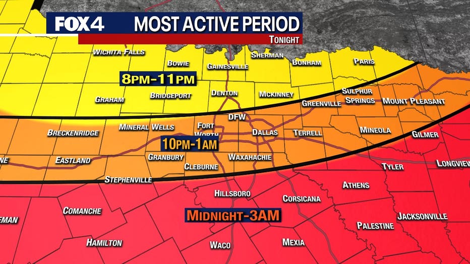
The line of severe t-storms is expected to push south of the Red River after 9pm. The line will bring a significant threat of damaging winds. The most active period for the DFW area appears to be between 10:30 p.m. and 12:30 p.m.
Keep up with the latest updates on Facebook: FOX 4 Weather
Damaging wind gusts could reach up to 75 miles an hour. Isolated tornadoes are possible, especially northeast of DFW. There will be up to an inch-and-a-half hail embedded in the storms.
Things should clear up for the majority of North Texas by 3 a.m.
Severe thunderstorms Tuesday morning brought brief heavy rain and some damaging hail to parts of North Texas.
Rainwater flowed through parking lots around 4:45 a.m. in Arlington. Some small, pea-sized hail fell as well and there was quite a bit of lightning.
FOX 4 viewer Stacy Reddy shared video of hail falling in North Richland Hills. Viewer Candi Carrothers posted photos of what looked like marble-sized hail that fell at her home in Azle, just northwest of Fort Worth.
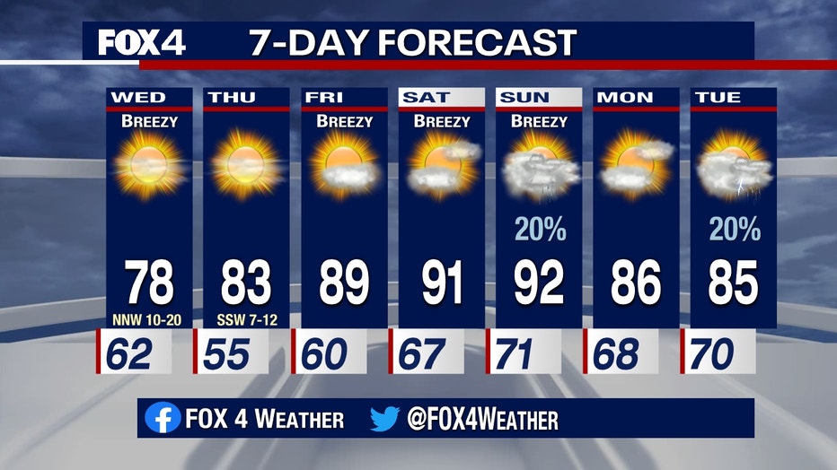
Wednesday will be windy and nice in the upper 70s. But by the end of the week and into the weekends the highs will be near the 90s.