

Heat advisories continue as North Texas faces triple-digit temperatures and high humidity
Dallas weather: July 28 morning forecast
The dog days of Summer are going nowhere! High pressure in control keeps us rain-free and hot for the rest of the week. Expect heat advisories each day, with actual temperatures ranging from 100-105 and heat indices at or above 105.
DALLAS - A persistent high-pressure system will keep North Texas locked in a midsummer heat wave through the rest of the workweek, bringing triple-digit temperatures, high humidity, and daily heat advisories before a weak cold front offers mild relief over the weekend.
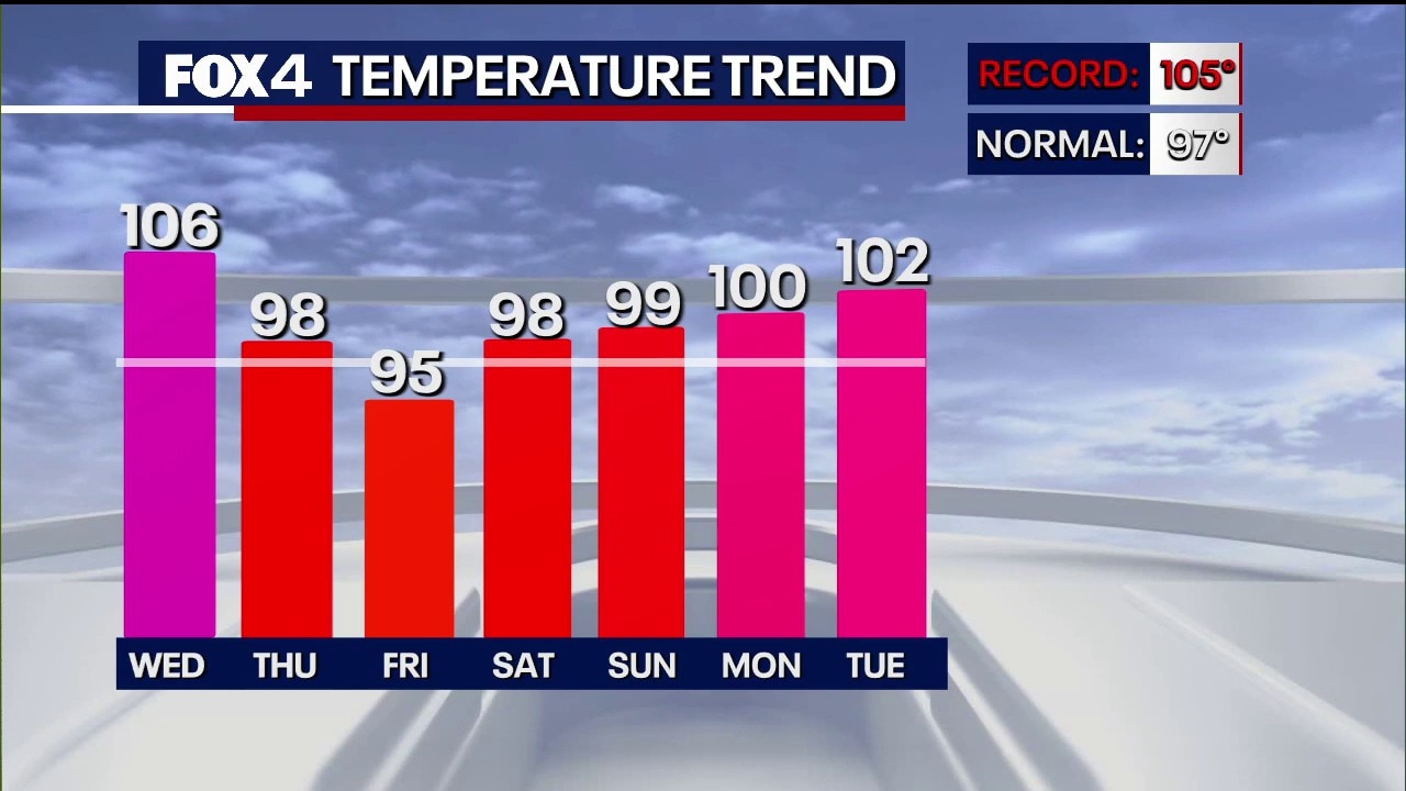
High temperatures are expected to reach around 102 degrees in the Dallas-Fort Worth area, remaining a few degrees above the regional normal of 97 degrees. While conditions will stay hot and uncomfortable, temperatures are projected to fall just short of record highs, such as the daily benchmark of 105 degrees.

Elevated heat index
Humidity levels will make conditions feel even hotter across the region. Heat index values are expected to run 5 to 10 degrees above air temperatures, with parts of East Texas—including Paris—facing heat index values up to 107 degrees.
A dominant ridge of high pressure is actively blocking storm systems and pushing cloud cover and severe weather well to the north toward the Midwest and Mid-Atlantic. As a result, North Texas faces a dry pattern that has contributed to declining water levels in area lakes. Officials noted that while lake levels have dropped to 1 to 2 feet below conservation capacity, conditions remain significantly better than in previous summer droughts.

A weak cold front scheduled to arrive early Saturday carries a slight 10% chance of rain. While the front will not bring significant rainfall or autumn-like temperatures, it will push through a slightly cooler, drier air mass.
By Sunday, high temperatures are forecast to drop back toward seasonable norms in the upper 90s with lower humidity, before temperatures begin a gradual upward climb again early next week.
7-Day Forecast

The Source: Information in this article is from the FOX 4 weather team.