

Dallas weather: Moisture from Hurricane Polo to bring heavy rain, flood risk to North Texas
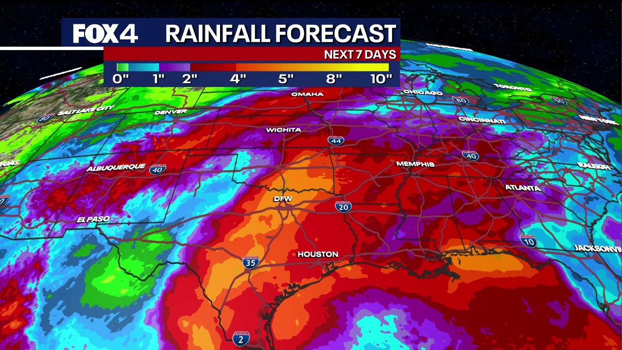
Dallas weather: Sept. 28 morning forecast
Tropical moisture pulled from Hurricane Polo will bring widespread rain, potential flood concerns, and cooler temperatures in the 80s to Texas starting Wednesday.
DALLAS - Relief from a relentless, scorching summer is on the horizon for North Texas as moisture from a Pacific hurricane prepares to deliver much-needed rainfall and cooler temperatures later this week.
Rain in Dallas this week
An upper-level high-pressure ridge that has trapped heat and dryness over the Lone Star State all summer is finally expected to flatten and push south. That shift will clear a path for a plume of moisture from the Pacific—currently fueled by a major Category 3 hurricane churning off the coast of the Baja Peninsula with 115-mph winds—to move into the region.
Live Radar

Weather this week in North Texas
Scattered showers and thunderstorms are forecast to ramp up by Wednesday night into Thursday, bringing widespread rainfall totals of 1 to 3 inches across North Texas over the next seven days. Isolated spots could see 4 to 5 inches.
While the rain is desperately needed to put a dent in ongoing drought conditions, the exceptionally dry soil could struggle to absorb heavy downpours quickly, raising the potential for localized flash flooding by the end of the week.
Ahead of the system, a low 20% chance of isolated afternoon showers and thunderstorms remains in the forecast early this week, primarily driven by daytime heating.
A drop in temperatures
Temperatures, however, are poised to drop significantly. After a couple more days of 90-plus-degree heat, highs are expected to retreat into the 80s by Thursday—bringing below-average temperatures to the area for the first time in months. Morning lows by the weekend are projected to dip into the upper 60s.
Rain chances are expected to persist through the work week and potentially linger into the weekend as a cold front moves through the region.
7-Day Forecast

The Source: Information in this article is from the FOX 4 weather team.