

Dallas weather: Severe Thunderstorm Watch in effect; hail, strong winds possible

Dallas weather: Your May 17 evening forecast
FOX 4 meteorologist Dylan Federico is tracking the chances for severe weather Saturday and Sunday, plus a look at the possibility of more storms early next week.
North Texas will see shots of storms for the next three days before finally seeing a bit of relief.
Not everyone will see these storms, but those that do could see large hail, strong winds and even a low tornado risk.
Severe Thunderstorm Watch
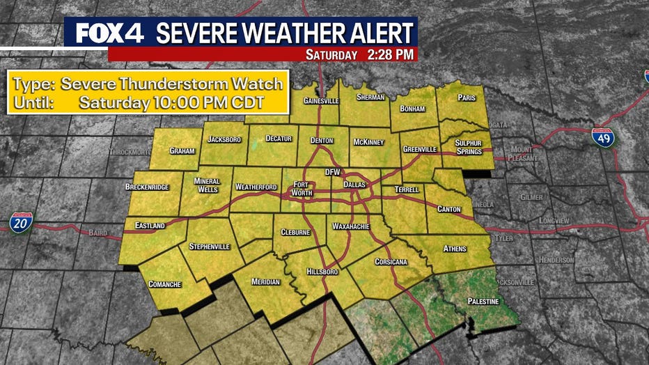
A severe thunderstorm watch was issued for North Texas through 10 p.m.
Live Radar
Saturday Forecast: Muggy day, PM storm chances
On Saturday morning, our dry line is retreating back to the west, meaning, outside of some briefly pleasant air to our northwest, we are feeling that warm and muggy air.
Temperatures will jump to near 90 with the heat index well into the 90s.
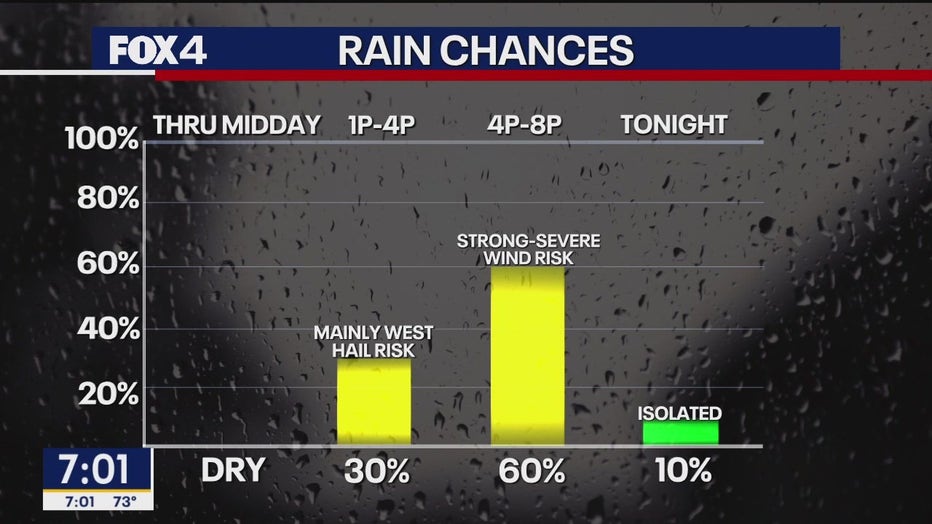
Saturday's storms will have the highest coverage of our storm chances over the next few days. We currently have coverage at about 70 percent of our area.
Timeline:
Storms will develop on the dry line to the west by the early to mid-afternoon.
On the early side, the initial storms will form around 2 p.m. to the west.
Those supercells will be capable of the nastiest hail, some wind risk and a low tornado threat.
The risk to the west will continue until about 5 p.m.
The storms will likely form into lines by the time they reach the Metroplex.
Generally, there will be less of a hail risk, but a high wind risk with gusts blowing 60 to 70 miles per hour in parts.
The storms will head into our eastern areas through sunset or just after.
Sunday Forecast: Muggy day, late storms possible (sound familiar?)
Sunday will also see another day of very warm, muggy air with a good south breeze and highs near 90.
Late day storms are possible, but we only have coverage set at about 40 percent.
The timing would be about 4 p.m. to 10 p.m.
The risk is for hail and high winds. There is not much of a tornado threat, but those risks are never zero.
Monday forecast: More storms possible
On Monday, about 40 to 50 percent of the area will see storms.
We expect a similar hail and wind risk.
The timing of Monday's storms will depend on what happens on Saturday and Sunday, so stay tuned.
7-Day Forecast
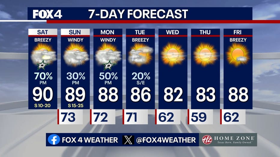
The last of the energy will swing through Tuesday morning with a cold front.
Any storms that do form on Tuesday will be in the early morning or just for the eastern areas. Humidity should drop by the afternoon with northwest winds and temperatures in the 80s.
We will finally get some decent May weather in the middle of the week.
It will be mostly sunny with drier air and highs in the low to mid 80s.
The Source: Information in this article comes from the FOX 4 weather team.