

North Texas tornadoes officially confirmed from Wise and Parker Counties on Saturday night
2 tornadoes confirmed in North Texas overnight
2 tornadoes confirmed in North Texas . Overnight storms brought 90 mph winds and large hail to North Texas, causing widespread damage across the region
DALLAS - The National Weather Service has confirmed that two tornadoes touched down in North Texas during severe storms Saturday night and into Sunday morning, including an EF-2 in Wise County and an EF-1 in neighboring Parker County.
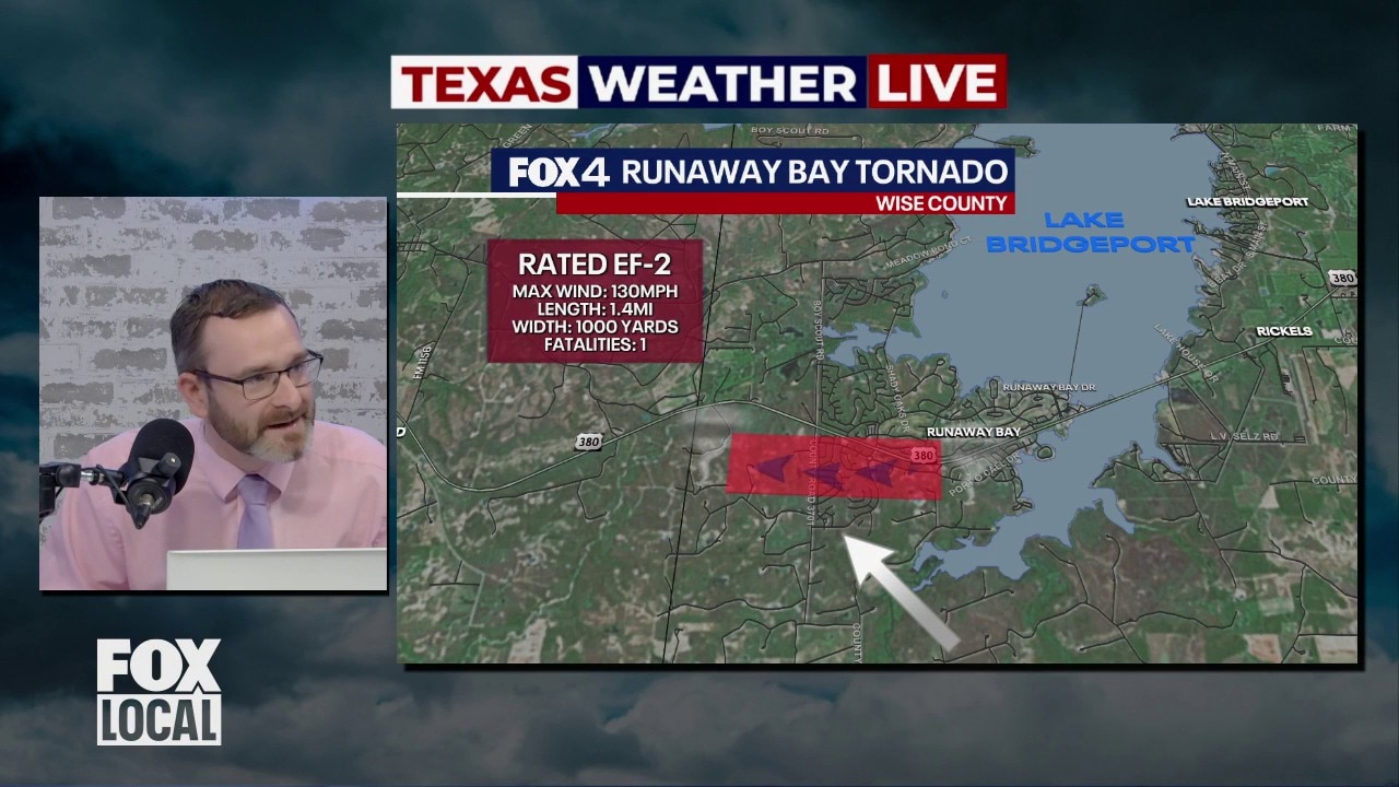
EF-2 tornado impacts Wise County

What we know:
The stronger tornado struck the Runaway Bay area near Lake Bridgeport, with survey teams estimating peak winds of 130 mph. The tornado was on the ground for about four minutes, from 9:03 p.m. to 9:07 p.m., and traveled roughly 1.4 miles.
Damage assessments show the tornado reached more than a half-mile in width at its peak and caused widespread impacts in residential areas, including heavy roof damage, destroyed manufactured homes and extensive tree loss.
Meteorologists also identified smaller embedded vortices within the tornado that produced pockets of more intense damage.
The storm’s path was notable for its westward movement, an atypical track for tornadoes, which more commonly move to the northeast.
EF-1 tornado path and damage in Parker County

Dig deeper:
A second tornado, rated EF-1, developed in Parker County west-northwest of Springtown at about 9:38 p.m. and tracked nearly 10 miles southeast before dissipating around 10:10 p.m. Peak winds were estimated at 105 mph.
Damage along that path primarily included downed tree limbs and roof damage, though two homes sustained significant structural impacts, including partial loss of second-story walls.
Enhanced Fujita Scale
Big picture view:
The Enhanced Fujita Scale classifies tornadoes into the following categories:
- EF-0 = 65–85 mph winds
- EF-1 = 86–110 mph winds
- EF-2 = 111–135 mph winds
- EF-3 = 136–165 mph winds
- EF-4 = 166–200 mph winds
- EF-5 = Over 200 mph winds
NWS preliminary findings
What's next:
The weather service said the apparent width of the Parker County damage path was measured at up to about two-thirds of a mile, and may include areas affected by strong rear-flank downdraft winds of 80 to 90 mph, meaning the tornado itself was likely narrower.
The National Weather Service said the survey findings are preliminary and may be refined as additional analysis is completed.
The Source: Information in this article was provided by FOX 4's Josh Johns and the National Weather Service.