

Dallas weather: Rain returns to the Metroplex as pollen levels surge
DALLAS - A typical spring pattern takes hold late this week as rain chances and warmer temperatures return to the Metroplex.
Monday Forecast
Dallas weather: Apr. 20 morning forecast
After a cool morning, we'll be in the low-70s this afternoon. Meteorologist Ali Turiano has your forecast.
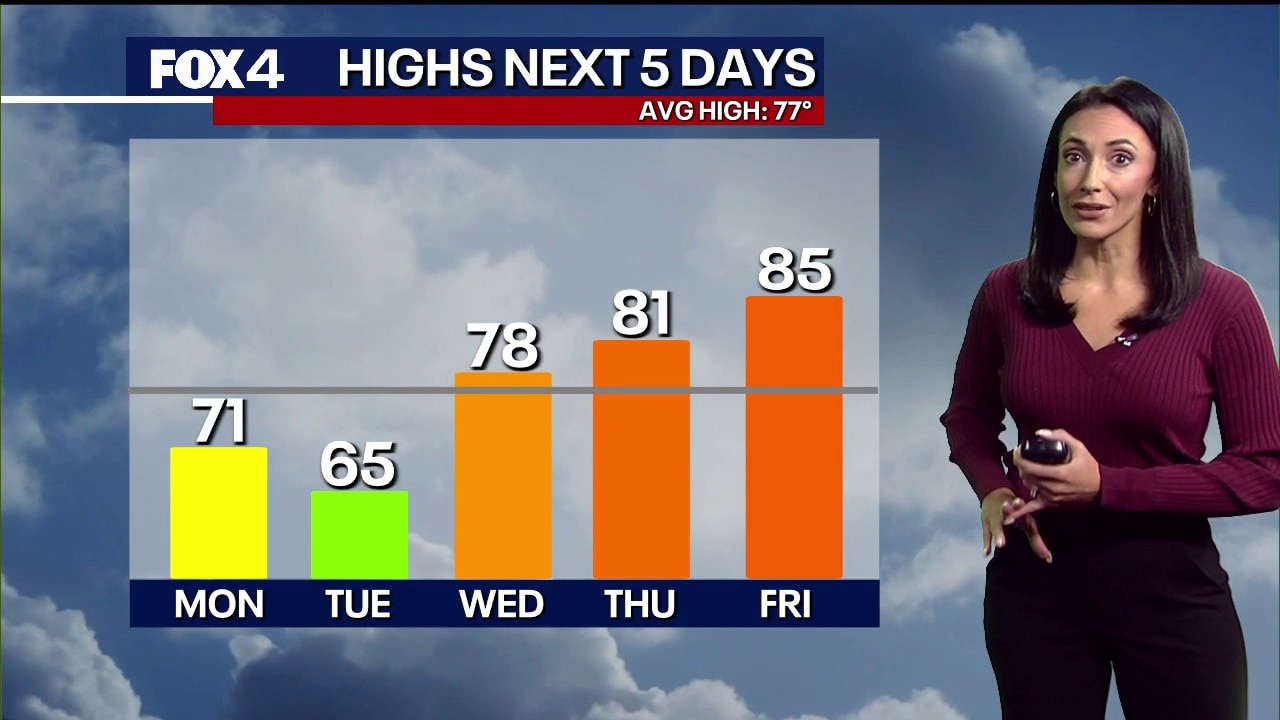
After a cool start this morning, expect increasing clouds with highs in the low 70s. Isolated showers will move in from the southwest throughout the afternoon.
Pollen Alert: Grab the Tissues

High tree pollen counts are returning to North Texas. Pollen levels will remain high through the first half of the week before a brief dip on Thursday. However, expect counts to surge to very high levels by Sunday. Ragweed and mold levels currently remain moderate.
7-Day Forecast

The next weather disturbance approaches tonight and continues into Tuesday morning, bringing scattered showers and thunderstorms. This rain is expected to exit to the east by Tuesday afternoon, leaving behind a cooler day with highs in the mid-60s. Most of North Texas will see rainfall totals of less than 0.5 inches, though isolated areas could receive higher amounts.
A warming trend begins midweek as temperatures climb into the high 80s by Friday. Forecasters are monitoring a dryline late in the week as disturbances move through the Plains and a front stalls nearby. While low rain and storm chances exist daily through the weekend, the setup warrants attention, as some of these storms have the potential to become strong or severe.
The Source: Information in this article comes from the National Weather Service and FOX 4 Forecasters.