

Dallas weather: Severe storm threat increases ahead of Tuesday night cold front
DALLAS - Heat and humidity are returning to the region early this week, bringing a threat of scattered storms and a brief spike in temperatures before a midweek cold front arrives.
Monday Forecast
Dallas weather: May 4 morning forecast
Sunshine and wind are in store today, but even hotter temperatures are just around the corner. Meteorologist Berkeley Taylor has your forecast.
Monday will be warm and breezy as afternoon highs climb into the mid-to-upper 80s. South winds will persist between 15 and 25 mph.
While humidity levels will rise throughout the day, the chance for storms remains slim and will likely be confined to the Red River valley, with most activity staying north of the Metroplex.
7-Day Forecast

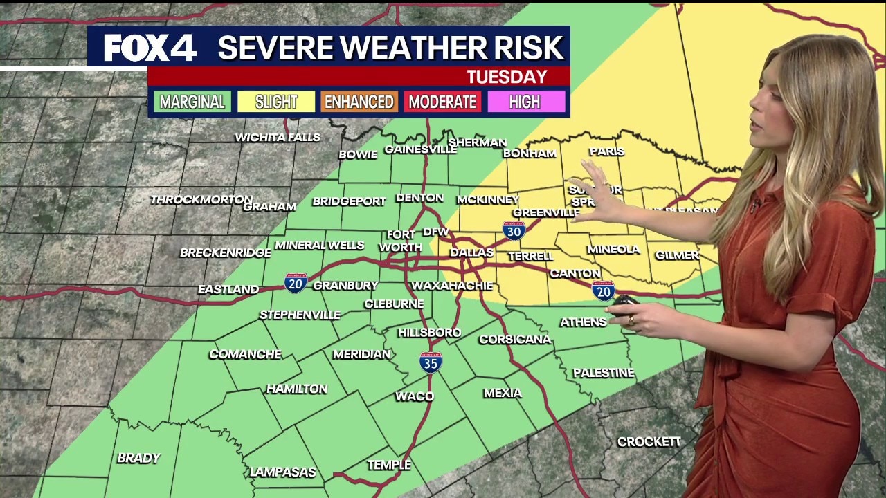
A more significant chance for rain arrives Tuesday evening with a cold front. There is currently a 30% chance for precipitation, though meteorologists note a "conditional" threat for strong or severe storms. If storms develop, large hail and damaging winds will be the primary concerns through the evening hours.
Scattered storms remain in the forecast Wednesday as the front lingers southeast of the Metroplex. Highs on Tuesday will be the warmest of the week, potentially reaching the low 90s, before the front provides much-needed relief.
Temperatures are expected to dip into the 70s for the remainder of the work week. Looking ahead to the weekend, another disturbance may bring scattered rain and storms on Saturday and Sunday as highs return to the 80s.
The Source: Information in this article comes from the FOX 4 Weather Team and the National Weather Service.