

Dallas weather: Cold front arrives overnight sending temps back below freezing

Enjoy the weather today, another cold snap is coming soon!
Thursday will be a nice break in the cold, with DFW Airport hitting 60 degrees. That's 3 degrees higher than average for this time of year.
Those winds will pick up on Thursday night, reaching 20 to 30 miles per hour.
That's the arctic front arriving.
We expect it to make its way through the area just after midnight.
Friday Forecast: Freezing Weather Returns
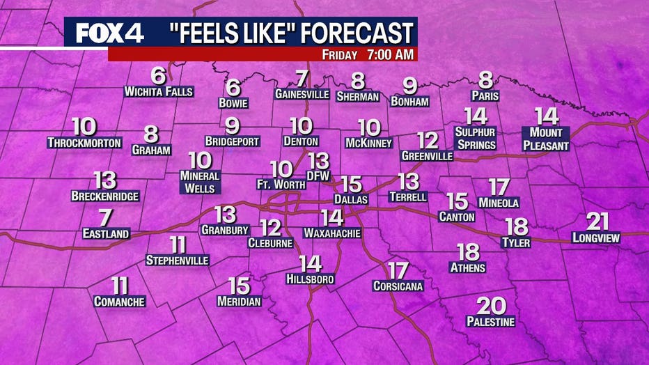
It will be windy and cold on Friday morning with a return to pipe freezing weather.
Temperatures will be in the low-to-mid 20s by the time you wake up on Friday, but it will feel even colder.
READ MORE: Prepare your pipes ahead of another cold front, North Texas plumbers warn
Winds will be blowing 20 to 25 miles per hour on Friday morning, driving wind-chills to the low-to-mid teens! It could even feel like the single digits up around the Red River.
Be sure to grab a big jacket before you head out the door.
Weekend Forecast: Cold Weekend
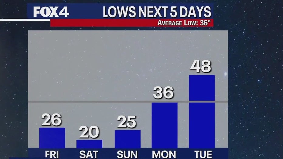
The coldest weather of this cold snap will be on Saturday morning, with temperatures in the low 20s.
Temperatures will climb on Sunday, but lows will still be below freezing.
The good news, is that there is no snow or sleet or freezing rain in the forecast.
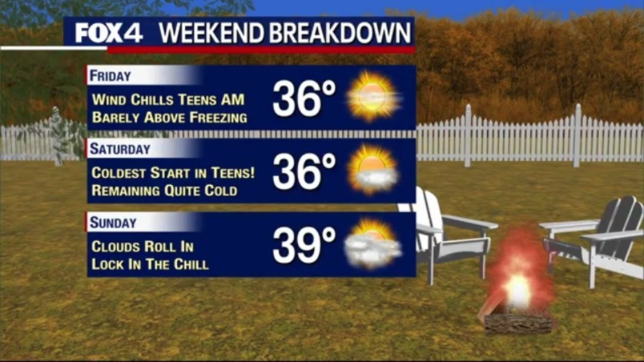
We will also be climbing above freezing during the day, so you will catch a few breaks.
7-Day Forecast: Rainy Weather Ahead

After that, get ready for some rain!
Sunday night into Monday we expect to see a very cold rain, with temperatures just above freezing.
There are high rain chances on Monday, Tuesday and Wednesday. It will not be a constant rain, but you should see plenty of drops.
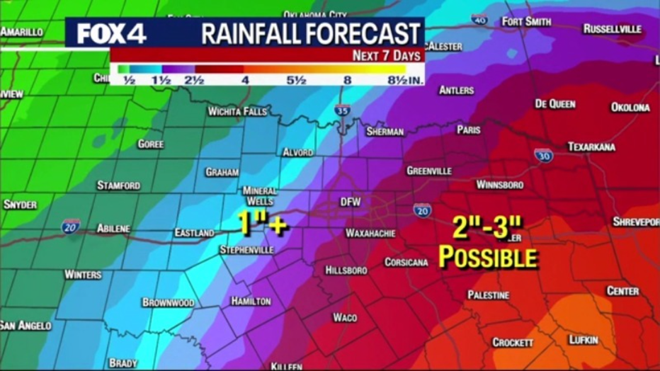
Areas to the west will see about an inch or more of rain over the next seven days, while people to the east could see up to three inches.
Temperatures will warm up throughout the week.