

North Texas gets rain and temperature relief before triple-digit summer heat returns
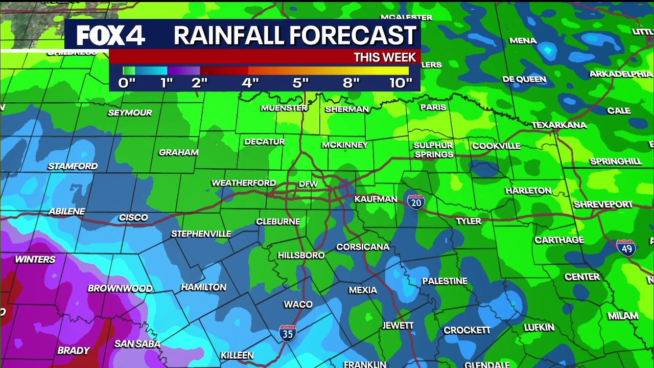
Dallas weather: July 15 morning forecast
Thanks to a disturbance hanging across the state, showers and storms remain possible for the rest of the work week. Today, expect partly to mostly cloudy skies.
DALLAS - North Texans can expect a brief reprieve from intense summer heat with scattered showers and mild mornings this week, though triple-digit temperatures are slated to return by early next week.
The lingering storm system that brought heavy rain to the region on Monday is finally moving out, leaving a 20% to 30% chance of isolated showers and thunderstorms through Friday before a high-pressure system builds back over the region.
Rain chances this week
Timeline:
While the Dallas-Fort Worth Metroplex sits at a modest 30% chance of rain Wednesday and Thursday, the highest potential for measurable rainfall will remain concentrated south of Interstate 20 and toward central Texas.
Wednesday: Higher rain chances will shift south of the Metroplex into central Texas.
Thursday: The best chance for storms shifts to the west, targeting communities like Mineral Wells, Decatur, and Jacksboro.
Friday: Rain chances drop to 20%, remaining highly isolated and primarily confined to western counties.
While regional rain will be highly localized, localized flooding remains a minor concern for areas saturated by earlier storms. Navarro County, which received heavy rainfall earlier in the week, could face localized flooding if any slow-moving afternoon thunderstorms develop.
Meanwhile, severe weather and flash flooding continue to plague the Texas Hill Country west of San Antonio, where some areas received over a foot of rain on Tuesday.
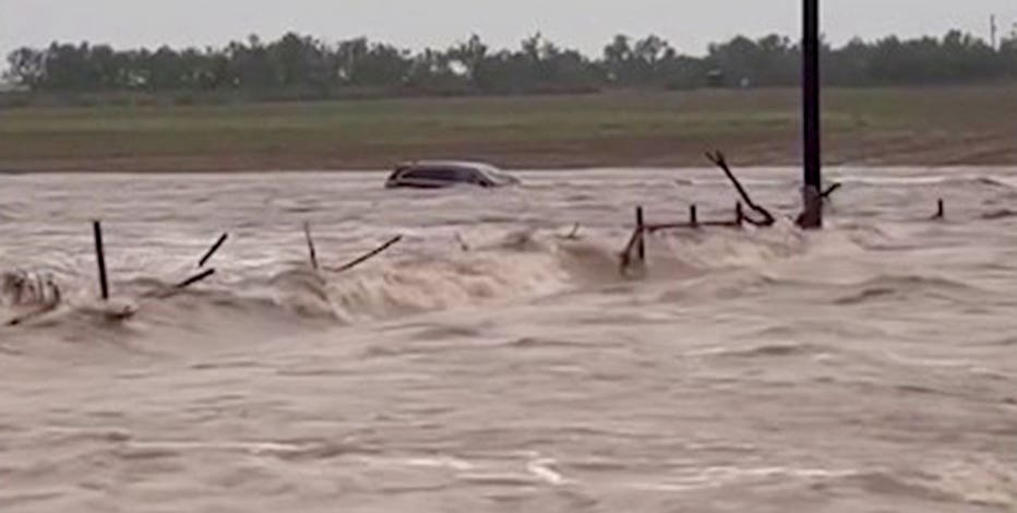
Millions in Texas face serious dayslong flash flooding threat
Millions across Texas face the risk of flash flooding this week.
A mild break before the bake
The cloud cover and scattered rain have kept morning temperatures remarkably mild for mid-summer, with most areas waking up in the upper 60s to low 70s. Urban centers like Dallas and Fort Worth remained slightly warmer in the mid-70s.
High temperatures through Friday are expected to remain in the upper 80s to low 90s—comfortably below average for this time of year. It really is looking pretty good considering how hot we know it can be this time of year.
Triple Digits Looming
The mild stretch will not last long. By the weekend, the high-pressure system will begin to dominate the region.
Temperatures will climb into the mid-90s on Saturday and Sunday. While these temperatures are "seasonably hot," the real test arrives early next week when triple-digit heat is forecast to make its return.
Residents are advised to enjoy the brief break in the heat, keep umbrellas handy through Friday, and prepare for intense sunshine and heat precautions by the weekend.
7-Day Forecast

The Source: Information in this article is from the FOX 4 weather team.