

Dallas weather: High-pressure ridge brings a dangerous wave of triple-digit summer heat
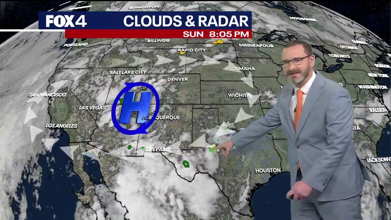
Dallas weather: July 19 overnight forecast
FOX 4's Josh Johns gives the latest weather forecast for much of North Texas and a look at flooding that has impacted the state.
DALLAS - A powerful ridge of high pressure building across the Plains is ushering in a prolonged stretch of dangerous, triple-digit heat and dry conditions across the region this week, pushing temperatures up to 10 degrees above normal for late July.
While Sunday’s forecast high is expected to max out just shy of the century mark at 99 degrees, a major warm-up is arriving quickly. Southerly winds between 10 and 20 mph will drive temperatures into the 90s before lunchtime, layout out the foundation for a scorching workweek.

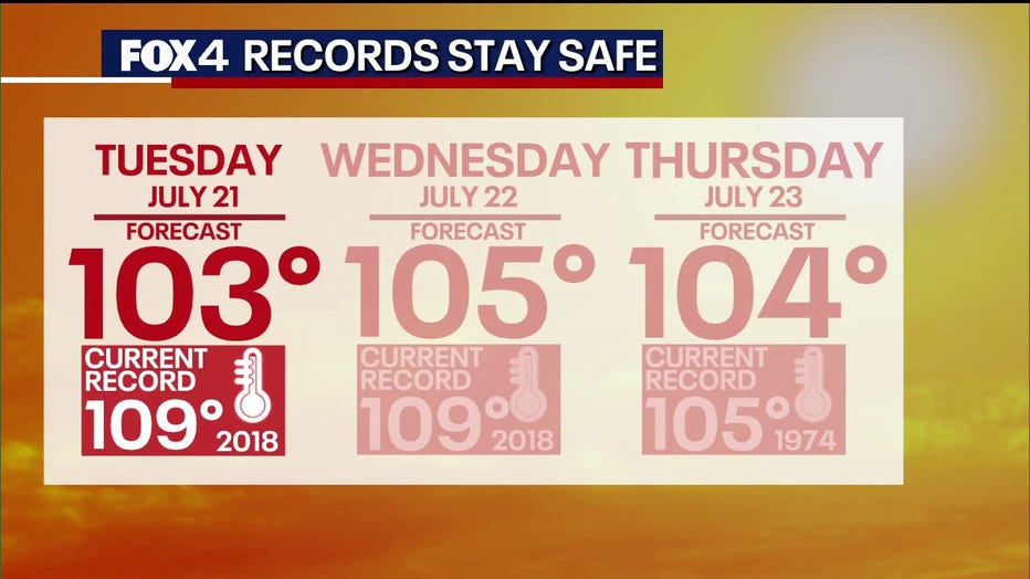
We expect triple-digit heat to take a firm hold by Monday and peak during a blistering three-day stretch from Tuesday through Thursday. Forecast highs are slated to reach 103 degrees on Tuesday, 105 on Wednesday, and 104 on Thursday.
When factoring in humidity, the heat index is projected to soar between 105 and 110 degrees, a threshold that will likely trigger widespread official heat advisories by midweek.
Despite the intense conditions, weather experts say most daily temperature records will remain intact. The records for Tuesday and Wednesday—both sitting at 109 degrees from 2018—are expected to hold. However, Thursday, July 23, could threaten history: the forecast high of 104 degrees is just one degree shy of the daily record of 105 set in 1974.
Any immediate relief from rainfall is effectively out of the question. A minor, isolated chance of rain remains below 10% for Sunday afternoon, but any lingering showers will collapse entirely after sunset as high pressure dominates the upper atmosphere.
While the dry spell brings a threat of intense heat to the immediate area, the multi-day cutoff of rain offers much-needed recovery time for communities farther south in Central Texas and the Hill Country.
The tropics
We are also closely monitoring the tropics, where the National Hurricane Center has upgraded a system in the Gulf of Mexico to a "high probability" for tropical development. The system, which could become Tropical Storm Bertha, is currently projected to hug the Florida coastline before tracking through the Gulf toward Louisiana.

While a shift in the tropical system's track represents the only realistic threat to breaking up the current heat dome, experts emphasize that its long-term path remains highly uncertain. For now, local residents should prepare for a relentlessly hot and dry week, with overnight lows offering little relief as they fail to drop below the 80s.
7-Day Forecast

The Source: Information in this article is from the FOX 4 weather team.