

Dallas weather: Flood Watch in effect as cooler weather and heavy rain move into the region
Dallas weather: Sept. 30 morning forecast
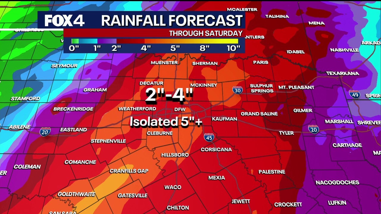
A Flood Watch is in effect Wednesday afternoon through Friday morning with 2–4 inches of rain expected. Stronger storms, small hail, and cooler temperatures arrive this week.
DALLAS - A multi-day stretch of wet, stormy weather is heading toward North Texas, bringing rising flood concerns and relief from unseasonable heat ahead of a weekend cold front.
Flood Watch in effect
Timeline:
While Wednesday morning is starting out quiet, warm, and windy, scattered showers and thunderstorms are expected to develop by the afternoon, particularly along and west of Interstate 35W.
Areas west of the metroplex are under a marginal risk for severe weather — a level 1 out of 5 — with the primary threats being gusty winds up to 60 mph and small hail smaller than quarters. The tornado threat remains very low.
Live Radar

How much will it rain in Dallas?
What we know:
A flood watch has been issued and extended through 7 a.m. Friday. Widespread totals of 2 to 4 inches are expected over a 24- to 48-hour period, with isolated amounts reaching 5 to 6 inches. Because the ground in the region is exceptionally dry, rapid runoff will quickly heighten the risk of localized flooding, especially as storms train over the same areas tonight and into Thursday morning.
Temperatures on Wednesday will peak near 92 degrees under humid conditions, accompanied by gusty winds ranging between 25 and 30 mph even before storms arrive.
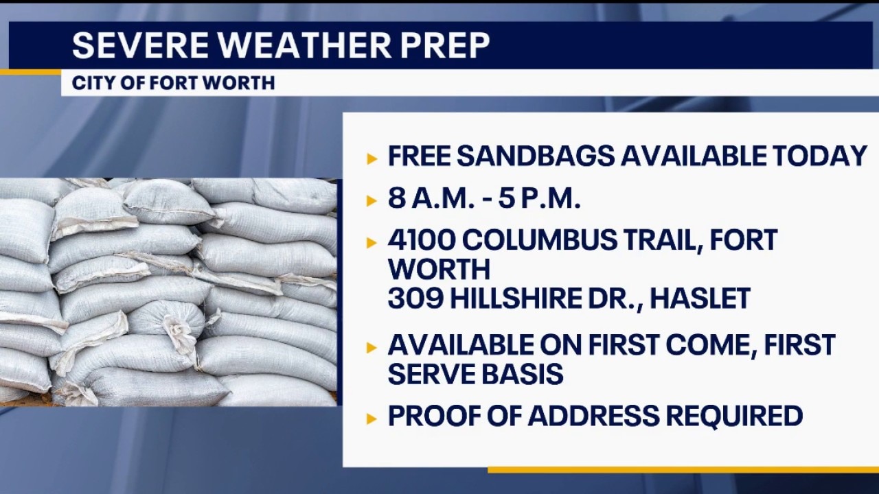
Fort Worth offers free sandbags to help residents prepare for heavy rain
The City of Fort Worth is providing free sandbags to residents starting today to help prepare for potential flooding from upcoming heavy rain and storms.
Cold front on its way
Conditions will remain unsettled through Thursday and Friday as an upper-level system stalls to the west, triggering multiple rounds of precipitation. A true cold front is slated to sweep through on Friday, ushering in much-needed cooler conditions.
Highs late in the week and into the weekend will drop into the upper 70s and lower 80s, with morning lows dipping into the comfortable low to mid-60s.
Scattered showers will linger into Saturday before coverage decreases on Sunday, leading to a drier start to next week.
7-Day Forecast

The Source: Information in this article is from the FOX 4 weather team.