

Tropical Storm Isaias could be forming in Gulf. What does that mean for Texas?
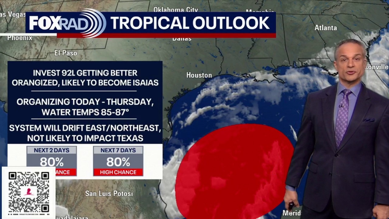
Houston weather: Sunny Tuesday, watching Invest 92L in the Gulf
It's going to be a pleasant and sunny Tuesday highs nearing 90. We are keeping an eye on Invest 92L in the Gulf as it has an increased chance of becoming a tropical depression or storm.
HOUSTON - Texas has its eyes peeled on the southern Gulf as a tropical disturbance gathers steam.
What we know:
The disturbance located in the Bay of Campeche is currently designated as Invest 92L. The National Hurricane Center uses "invest" to describe a system that is being closely monitored.
The NHC gives the disturbance a high chance of development over the next couple of days.

(FOX Weather)
What we don't know:
It's not yet clear how strong the system will become once it develops. However, if the disturbance strengthens into a tropical depression, it will get a number. If it becomes a tropical storm, it will get the name Isaias.
What does the tropical disturbance in the Gulf mean for Texas?
Most computer forecast models agree that whatever develops will not be a big problem for Texas. However, anytime there is a tropical system in the Gulf, it is worth watching closely.
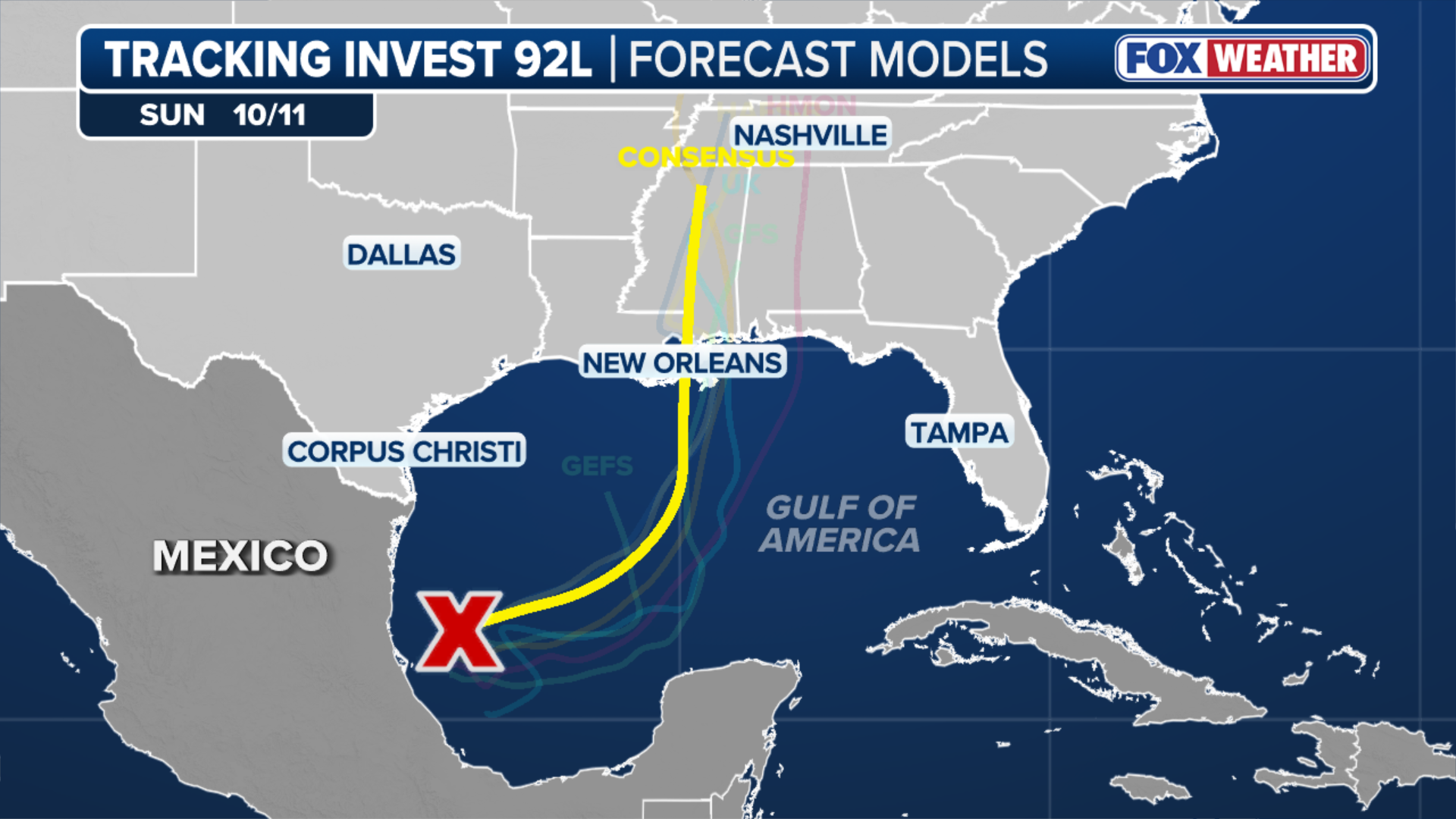
(FOX Weather)
It doesn’t take a landfalling tropical system to cause problems for coastal Texas, though. With a system in the Gulf, rip currents and coastal flooding can become problems in addition to the heavy rain and gusty winds that they can bring.
The National Weather Service office in Corpus Christi has issued a coastal flood advisory for the barrier islands until 7 p.m. Tuesday.
Forecasters said water could be pushed up to beach dunes on the Aransas, Kleberg, Nueces and Calhoun islands. This can lead to difficult driving and blocked roads.
Parts of the Texas coast will also see enhanced rainfall chances this weekend as the system moves toward the northern Gulf Coast.
The Source: Information in this story came from the National Hurricane Center, the National Weather Service and FOX Weather.