

Dallas weather: North Texas has a chance to see severe storms Thursday with hail, damaging winds

Severe storms are possible across North Texas on Thursday afternoon.
Thunderstorm and tornado watches have been issues for areas to the west of DFW.
The Storm Prediction Center has much of the DFW area under a ‘slight’ risk of severe weather on Thursday. That's a 2 on a 1 to 5 scale.
Large hail and damaging winds are the main threats for the area, but there is a non-zero chance of an isolated tornado.
The Storm Prediction Center expanded the area under the ‘slight’ risk on Wednesday afternoon. Originally, it only included the areas west of I-35. That area is still the most likely to see severe weather.
Some could make their way to the DFW area between 8 and 11 p.m.
The storms are expected to begin after 6 p.m. on Thursday and the threat could stick around through midnight.
We could see up to golf ball-sized hail and wind gusts up to 60 miles per hour.

The Danger of Hail
FOX 4 meteorologists Dan Henry and Ali Turiano talk about what causes hail to form and just how destructive it can be.
Live Radar

Live Updates
7-Day Forecast
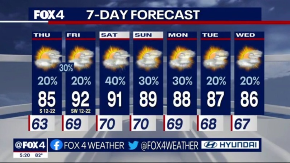
After Thursday, some rain could return to the forecast late on Friday as temperatures climb into the 90s!
There are shots at rain for most of the next week with temperatures in the high 80s and 90s.