

Dallas weather: Mostly peaceful night ahead of Mother's Day storms
Dallas weather: May 9 evening forecast
FOX 4 meteorologist Josh Johns has your evening forecast for May 9.
DALLAS - North Texas will stay mostly quiet Saturday night, with only a slight chance of isolated storms in far northwestern counties near Wichita Falls, Graham, and areas like Jack, Young, and Montague counties.
The Dallas-Fort Worth Metroplex is expected to remain dry overnight.
Mother's Day weather outlook
What's next:
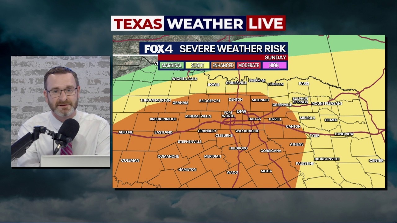
The focus shifts to Sunday (Mother’s Day), when the Storm Prediction Center places all of North Texas under a Level 2 (slight) risk, with the Metroplex included in a Level 3 (enhanced) risk for severe weather.

DFW Sunday radar
Storms could begin as early as late morning near the Red River, mainly north of Highway 380, before redeveloping in the afternoon. The primary window for severe weather is expected between 3 p.m. and 10 p.m., with peak impacts likely around dinnertime.
Main threats
The most potential for severe weather will likely manifest in damaging winds up to 60–70 mph, and large hail, potentially egg-sized or bigger.
The tornado threat appears low but not zero.

Storms are expected to move out by late evening, with quieter conditions returning Monday. Some areas, especially in southern North Texas, could see an inch or more of rainfall.
What you can do:
Residents are encouraged to stay weather-aware and monitor updates through the FOX Local app and your FOX 4 Weather Team meteorologists.
The Source: Information in this article comes from the FOX 4 Weather Team.