

Dallas weather: Risk of severe weather Friday, Saturday
There is a risk of severe weather in North Texas this weekend and a few shots of rain before that.
Thursday Forecast: Cloudy, Windy
It will be another warm, humid day in North Texas, but it will be windy.
South winds will blow between 15 to 25 miles per hour on Thursday. Those winds are expected to only get stronger as we move through the end of the week.
The jet stream is bringing moisture into our area, meaning you can expect to see clouds for most of the day.
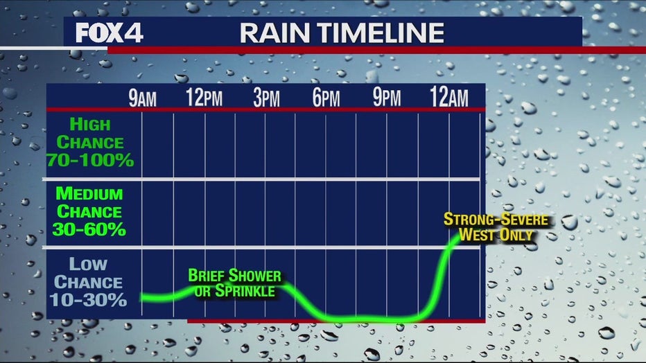
There is a small chance of a brief shower on Thursday, but the higher chances won't be until after midnight.
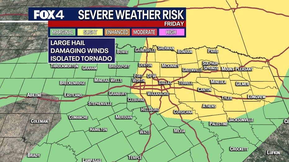
Friday Forecast: Scattered storms, severe weather chance to the west
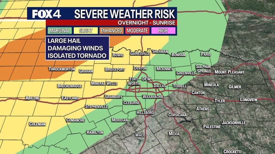
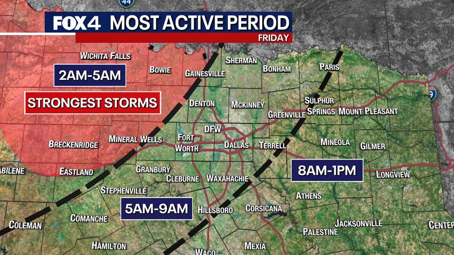
You can expect to see some storms in the early morning hours of Friday.
The storm, which brought rain to the east of Vegas on Thursday morning, will make its way to North Texas.
The worst of the storms will be to the west of North Texas. Areas like Wichita Falls will see an enhanced chance of severe weather.
From about 2 to 4 a.m. the storms will make their way to our western counties.
There could be a risk of hail or gusty winds.
By the time those storms reach DFW there will mostly be a low-end wind risk.
Friday afternoon and night could also see storms, but that will be mostly for people who live east of Dallas.
Saturday Forecast: Severe storm chance
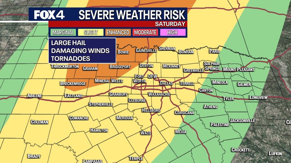
A second storm moving into North Texas from the Pacific Northwest will bring our highest risk of severe weather.
Most of the day will be fine, just extremely windy.
On Saturday afternoon, we could see all forms of severe weather, including damaging winds, large hail and even a tornado in our western counties.
The storms are expected to turn into a squall line at night, especially from the Metroplex to the west.
Squall lines historically bring high winds and heavy rain.
The storms could stick around past midnight as they push east.
7-Day Forecast
