

Dallas weather: Strong to severe storms expected overnight
DALLAS - Our next round of rain and storms is expected to move through North Texas Wednesday night into Thursday morning.
Wednesday forecast: Rain, Storms overnight
It will be a warm and humid afternoon for us on Wednesday.
A flow of tropical moisture will move into our area from the Pacific Ocean.
The moisture will move across Mexico and into west Texas before reaching us.
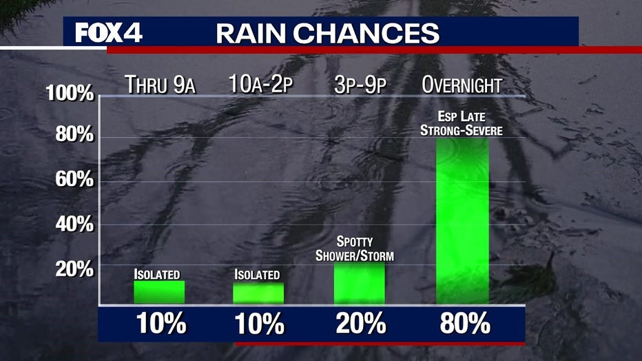
You could see an isolated shower or two today, but the weathermaker to keep an eye on won't come until after midnight.
Overnight Wednesday there is about an 80% chance of coverage of rain and storms.
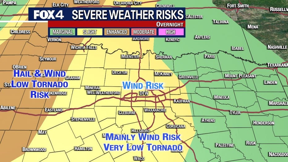
Most of North Texas has a slight chance of severe weather, according to the Storm Prediction Center. That's a 2 on the 1-5 scale.
The main issue for most of us will be a wind risk, along with the rain.
There is a higher chance of hail and a low tornado risk to the far west.
Areas to the south are expected to get the most rain.
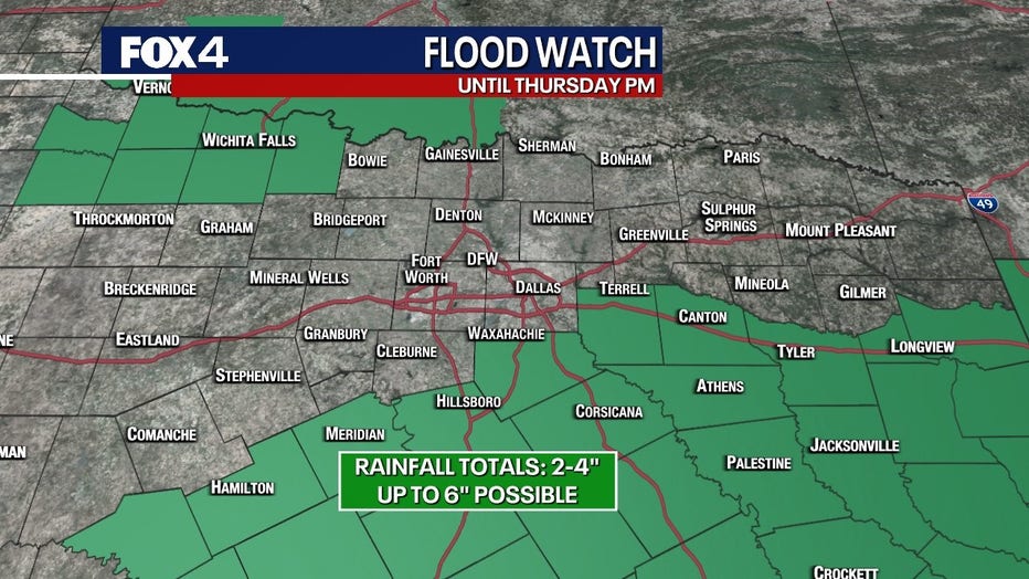
A Flood Watch has been issued for southern counties until Thursday at 1 p.m.
Thursday Forecast: Lingering Rain, Scattered Showers
By the time you wake up on Thursday morning, there will be some lingering rain, especially if you live to the east of DFW.
There will be a break from the rain for most of the day.
There will be more in the PM hours, but those will be scattered.
Friday Forecast: On and Off Showers
The rain isn't going to stop on Friday.
There is a 30% chance of rain on Friday, with spotty showers and storms.
There will be plenty of breaks in between the rain, but just be ready for the rain.
Keep an eye on our forecast as we get closer to Friday for the timing.
Weekend Forecast: More Showers, Storms
Saturday is another day where we expect scattered rain.
The rain chances ramp up as we move overnight from Saturday into Sunday.
Sunday there is about a 40% chance you will see rain.
High temperatures are expected to be in the 80s and lows will be in the high 60s.
Live Radar - North Texas

7-Day Forecast
