

Dallas weather: Risk of severe storms Tuesday through Thursday
Storms are coming to North Texas, but you may not see them depending on where you live.
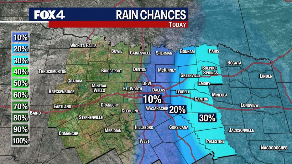
Tuesday Forecast: Storm chances to the East
Early Tuesday morning, some areas saw severe storms, including up to quarter-sized hail.
There is another shot at rain later in the day.
A weak cold front is moving slowly through the area in the afternoon to evening.
There's a chance of isolated storms.
The storms come with a chance of hail and high winds.
The Storm Prediction Center says there is a marginal risk of severe weather, the lowest level on its 1 to 5 scale.
If you live to the east or northeast of the Metroplex you will have the highest chance of seeing a storm.
Most of the area won't probably see any rain or storms.

A severe thunderstorm warning was issued for Dallas, Ellis, Henderson and Kaufman County.
Wednesday Forecast: Storm chances West
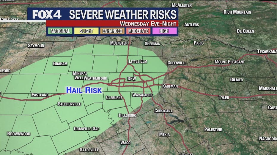
Wednesday night, around 8 p.m. to 9 p.m., is when we expect to see storms bubble up for more of North Texas.
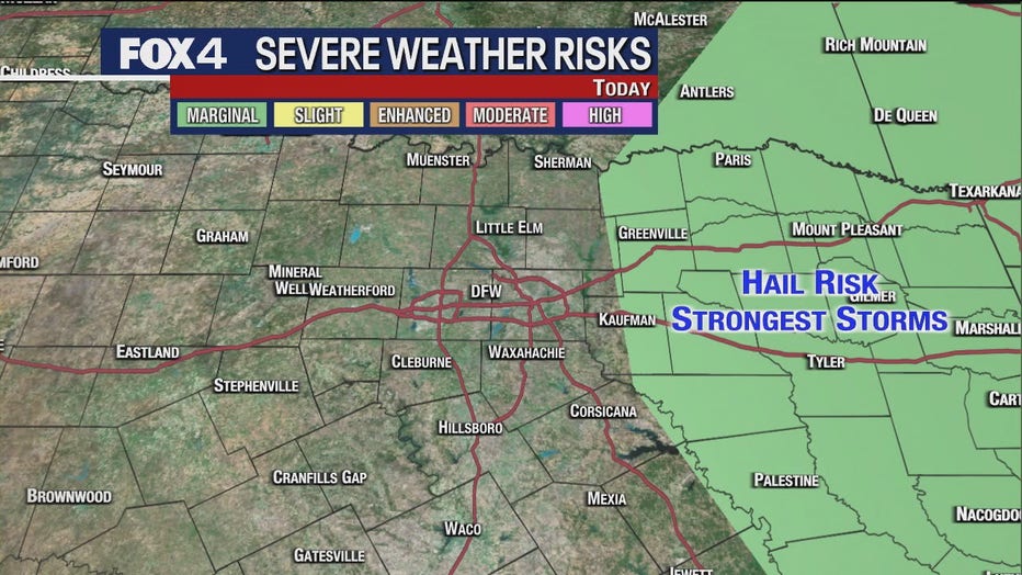
Late in the day Wednesday, there is a hail risk mostly to the west, but it includes the Metroplex.
That storm system also brings a marginal risk of severe weather.
Thursday Forecast: Strong to Severe Storm Chances
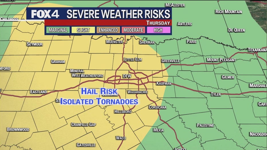
Thursday is our best chance of strong to severe storms, with large hail and even a possibility of a low tornado risk.
The Storm Prediction Center says there is a slight risk of severe weather, which is a 2 on its 1 to 5 scale.
Keep an eye on our forecast to see if there are any changes as we get closer to Thursday.
7-Day Forecast

The storms should move out of North Texas by Friday morning.
Your weekend will be cooler than we have been seeing.
High temperatures will be in the 60s on Saturday and Sunday, with lows in the 40s.